Cangas de Onís
| Cangas de Onís Cangues d'Onís | |||
|---|---|---|---|
| Municipality | |||
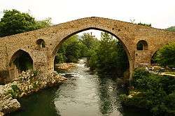 The hump-backed "Roman Bridge" on the Sella River | |||
| |||
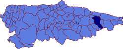 | |||
 Cangas de Onís Location in Spain | |||
| Coordinates: 43°21′N 5°8′W / 43.350°N 5.133°W | |||
| Country |
| ||
| Autonomous community |
| ||
| Province | Asturias | ||
| Comarca | Oriente | ||
| Judicial district | Cangas de Onís | ||
| Capital | Cangas de Onís | ||
| Government | |||
| • Alcalde | Jose Manuel González Castro (PP) | ||
| Area | |||
| • Total | 212.75 km2 (82.14 sq mi) | ||
| Highest elevation | 2,478 m (8,130 ft) | ||
| Population | |||
| • Total | 6,731 | ||
| • Density | 32/km2 (82/sq mi) | ||
| Demonym(s) | cangués | ||
| Time zone | UTC+1 (CET) | ||
| • Summer (DST) | UTC+2 (CEST) | ||
| Postal code | 33547 to 33559 | ||
| Website | Official website | ||


Cangas de Onís (Asturian: Cangues d'Onís "valleys of Onís"[1]) is a municipality in the eastern part of the province and autonomous community of Asturias in the northwest of Spain. The capital of the municipality is also Cangas de Onís.
More than seventy square kilometres of the concejo form part of the Parque nacional de los Picos de Europa.
History
Within the park is the village of Covadonga, where the battle of Covadonga (about 722), the first major victory by a Christian military force in Iberia after the Islamic conquest, marks the starting-point of the Reconquista. Cangas de Onís is the site of the first church constructed in post-conquest Iberia, Santa Cruz de Cangas de Onís (737), built on an ancient dolmen.
A parish named Cangas de Onís is attested for the 14th century. The stone bridge across the Sella River was built in the 14th or 15th century.
Cangas de Onís was represented in the Junta General of the principality of Asturias in 1504. Covadonga began to be developed as a pilgrimage site in the 16th century, attracting commerce. The settlement of Cangas de Onís grew rapidly in the mid 19th century. A meteorite fall is recorded for the year 1866.
Cangas de Onís was bombarded several times in the Spanish Civil War. It served as the seat of the Regional Council in the "pre-autonomous regime" of 1978–1981 prior to the entering into force of the Statute of Autonomy of the Principality of Asturias on 31 January 1982.
Vegetation
Given its varied height it has many types of plants, including many mountain shrubs, heather; oak, have and ash trees, rounded by grassland and copes.
Economy
The main economic activities of this region are agriculture and cattle rearing along with rural tourism. The nearby Covadonga Sanctuary and its surrounding lakes are one of the main tourist destinations in Asturias.
Parishes
Cangas de Onís is divided in eleven parishes:
The capital of the municipality is the parish of Cangas de Onís. It is 27.22 km2 (10.51 sq mi) in size with a population of 4,326 (INE 2005). The postal code is 33550 and is divided in several villages:
- Cañu
- Cabielles
- Cangues
- Cardes
- Celangu
- Ḥelgueres
- Llueves
- Ñarciandi
- Ñeda
- Onao
- Següencu
- Torió
- Tornín
Gallery
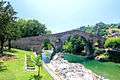 13th century bridge over Rio Sella
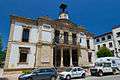 Town Hall in Cangas de Onís
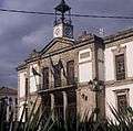 Town Hall
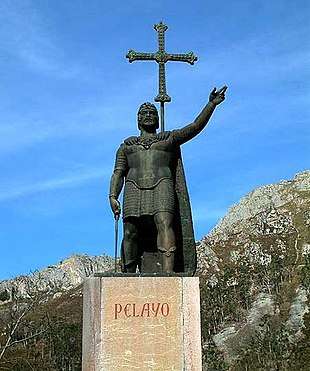 Statue of the King Pelayo
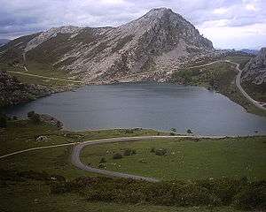 Enol Lake at Covadonga
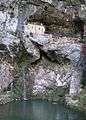 Holy Cave of Covadonga
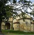 Monastery of San Pedro de Villanueva (12th century) - Church
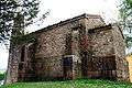 Church of Santa Cruz - Lateral side
_-_04.jpg) Chapel of Santo Medero
Chapel of Santo Medero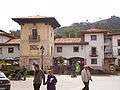 Pintu Palace
References
External links
| Wikisource has the text of the 1911 Encyclopædia Britannica article Cangas de Onís. |
- Guía turística (in Spanish)
- www.cangasdeonis.com (in Spanish)
- Cangas de Onís (in Spanish)
- Casa Rural (in Spanish)
- Cangas de Onís