Cambridge–Dorchester Airport
| Cambridge–Dorchester Regional Airport | |||||||||||
|---|---|---|---|---|---|---|---|---|---|---|---|
 | |||||||||||
| Summary | |||||||||||
| Airport type | Public | ||||||||||
| Owner | Dorchester County Commissioners | ||||||||||
| Serves | Cambridge, Maryland | ||||||||||
| Elevation AMSL | 20 ft / 6 m | ||||||||||
| Coordinates | 38°32′22″N 076°01′49″W / 38.53944°N 76.03028°WCoordinates: 38°32′22″N 076°01′49″W / 38.53944°N 76.03028°W | ||||||||||
| Map | |||||||||||
 CGE Location of airport in Maryland | |||||||||||
| Runways | |||||||||||
| |||||||||||
| Statistics (2007) | |||||||||||
| |||||||||||
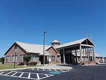
Cambridge–Dorchester Regional Airport (IATA: CGE, ICAO: KCGE, FAA LID: CGE) is a county-owned, public-use airport located three nautical miles (6 km) southeast of the central business district of Cambridge, in Dorchester County, Maryland, United States. Amber L. Hulsey, A.B.D, ASC is the Airport Director.[1]
Facilities and aircraft
Cambridge–Dorchester Regional Airport covers an area of 555 acres (225 ha) at an elevation of 20 feet (6 m) above mean sea level. It has one runway designated 16/34 with a 4,477 x 75 ft (1,365 x 23 m) asphalt surface.[1]
For the 12-month period ending June 1, 2007, the airport had 25,698 aircraft operations, an average of 70 per day: 99% general aviation and 1% military. At that time there were 49 aircraft based at this airport: 80% single-engine, 6% multi-engine, 2% jet, 2% helicopter and 10% ultralight.[1]
References
External links
- Cambridge–Dorchester Airport (CGE) at Maryland Aviation Administration
- Airport page at Dorchester County web site
- Airport page at Dorchester County Office of Tourism web site
- Resources for this airport:
- FAA airport information for CGE
- AirNav airport information for KCGE
- ASN accident history for CGE
- FlightAware airport information and live flight tracker
- NOAA/NWS latest weather observations
- SkyVector aeronautical chart, Terminal Procedures