California State Route 53
| ||||
|---|---|---|---|---|
 SR 53 highlighted in red | ||||
| Route information | ||||
| Defined by Streets and Highways Code § 353 | ||||
| Maintained by Caltrans | ||||
| Length | 7.45 mi[1] (11.99 km) | |||
| Major junctions | ||||
| South end |
| |||
| North end |
| |||
| Location | ||||
| Counties | Lake | |||
| Highway system | ||||
| ||||

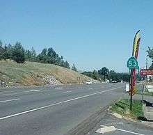
State Route 53 (SR 53), also known as the Clearlake Expressway, connects SR 29 and SR 20 via the city of Clearlake. It runs in a north–south direction east of Clear Lake.
Route description
SR 53 begins at California State Route 29 in the town of Lower Lake, near Anderson Marsh State Historic Park, primarily as a four-lane divided semi-rural expressway. The highway then heads northward along Clear Lake, the largest freshwater lake located entirely in California. It bypasses the center of Clearlake, California, instead going through the neighborhood of the "Avenues". Once it crosses Lakeshore Drive, it narrows down to a two-lane highway until its northern terminus at California State Route 20 north of the city limits.[2]
State Route 53 is part of the California Freeway and Expressway System,[3] and is part of the National Highway System,[4] a network of highways that are considered essential to the country's economy, defense, and mobility by the Federal Highway Administration.[5] SR 53 is eligible for the State Scenic Highway System,[6] but it is not officially designated as a scenic highway by the California Department of Transportation.[7]
Major intersections
Except where prefixed with a letter, postmiles were measured on the road as it was in 1964, based on the alignment that existed at the time, and do not necessarily reflect current mileage. R reflects a realignment in the route since then, M indicates a second realignment, L refers an overlap due to a correction or change, and T indicates postmiles classified as temporary (for a full list of prefixes, see the list of postmile definitions).[8] Segments that remain unconstructed or have been relinquished to local control may be omitted. The entire route is in Lake County.
| Location | Postmile [8][1][9] | Destinations | Notes | ||
|---|---|---|---|---|---|
| Lower Lake | 0.00 | South end of SR 53 | |||
| Clearlake | 1.47 | Lakeshore Drive; Old State Highway | Former SR 53 north | ||
| 2.96 | Clearlake Highlands, 40th Avenue | Former SR 53 south | |||
| | 7.45 | North end of SR 53 | |||
| 1.000 mi = 1.609 km; 1.000 km = 0.621 mi | |||||
See also

References
- 1 2 California Department of Transportation (April 2008). "Log of Bridges on State Highways". Sacramento: California Department of Transportation.
- ↑ California Road Atlas (Map). Thomas Brothers. 2008.
- ↑ California State Legislature. "Section 250–257". Streets and Highways Code. Sacramento: California State Legislature. Retrieved June 9, 2017.
- ↑ Federal Highway Administration (March 25, 2015). National Highway System: California (North) (PDF) (Map). Scale not given. Washington, DC: Federal Highway Administration. Retrieved October 14, 2017.
- ↑ Natzke, Stefan; Neathery, Mike & Adderly, Kevin (June 20, 2012). "What is the National Highway System?". National Highway System. Washington, DC: Federal Highway Administration. Retrieved July 1, 2012.
- ↑ California State Legislature. "Section 260–284". Streets and Highways Code. Sacramento: California State Legislature. Retrieved June 9, 2017.
- ↑ California Department of Transportation (September 7, 2011). "Officially Designated State Scenic Highways and Historic Parkways". Sacramento: California Department of Transportation. Retrieved October 14, 2017.
- 1 2 California Department of Transportation. "State Truck Route List". Sacramento: California Department of Transportation. Archived from the original (XLS file) on June 30, 2015. Retrieved June 30, 2015.
- ↑ California Department of Transportation, All Traffic Volumes on CSHS, 2007
External links
Route map:
| Wikimedia Commons has media related to California State Route 53. |