California State Route 175
| ||||
|---|---|---|---|---|
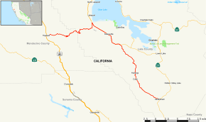 Map of western California with SR 175 highlighted in red | ||||
| Route information | ||||
| Defined by Streets and Highways Code § 475 | ||||
| Maintained by Caltrans | ||||
| Length | 37.89 mi[1] (60.98 km) | |||
| Restrictions | No vehicles more than 39 feet (12 m) in length between Hopland and Lakeport[2] | |||
| Major junctions | ||||
| West end |
| |||
|
| ||||
| East end |
| |||
| Location | ||||
| Counties | Mendocino, Lake | |||
| Highway system | ||||
| ||||

State Route 175 (SR 175) is a state highway in California, United States, connecting Hopland in Mendocino County and Middletown in Lake County.
Route description
SR 175 connects U.S. Route 101 at Hopland to State Route 29 near Lakeport through the Mayacamas Mountains. From there it joins SR 29 until Kelseyville, where it loops out until meeting SR 29 again at its end at Middletown. The section between Hopland and Lakeport is also known locally as the "Hopland Grade", or "Hopland Pass."
Except for the portion on SR 29, SR 175 is not part of the National Highway System,[3] a network of highways that are considered essential to the country's economy, defense, and mobility by the Federal Highway Administration.[4]
History
Originally constructed in the early 1920s, it is one of the steepest and most difficult to drive of any California state highway. Until recently it was called the "crookedest road in California". Vehicles more than 39 feet (12 m) in length are banned from the Hopland Grade, due to its many tight hairpin turns and curves.[2]
Major intersections
Except where prefixed with a letter, postmiles were measured on the road as it was in 1964, based on the alignment that existed at the time, and do not necessarily reflect current mileage. R reflects a realignment in the route since then, M indicates a second realignment, L refers an overlap due to a correction or change, and T indicates postmiles classified as temporary (for a full list of prefixes, see the list of postmile definitions).[5] Segments that remain unconstructed or have been relinquished to local control may be omitted. The numbers reset at county lines; the start and end postmiles in each county are given in the county column.
| County | Location | Postmile [5][1][6] | Destinations | Notes | |
|---|---|---|---|---|---|
| Mendocino MEN 0.00-9.85 | Hopland | 0.00 | West end of SR 175 | ||
| Lake LAK 0.00-28.04 | | R8.19 R40.14[N 1] | West end of SR 29 overlap | ||
| | 31.05[N 1] 8.25 | East end of SR 29 overlap | |||
| Middletown | 28.04 | East end of SR 175 | |||
1.000 mi = 1.609 km; 1.000 km = 0.621 mi
| |||||
See also

References
- 1 2 California Department of Transportation (July 2007). "Log of Bridges on State Highways". Sacramento: California Department of Transportation.
- 1 2 "Special Route Restriction History - Route 175". Caltrans. Retrieved 2018-10-13.
- ↑ Federal Highway Administration (March 25, 2015). National Highway System: California (North) (PDF) (Map). Scale not given. Washington, DC: Federal Highway Administration. Retrieved September 17, 2017.
- ↑ Natzke, Stefan; Neathery, Mike & Adderly, Kevin (June 20, 2012). "What is the National Highway System?". National Highway System. Washington, DC: Federal Highway Administration. Retrieved July 1, 2012.
- 1 2 California Department of Transportation. "State Truck Route List". Sacramento: California Department of Transportation. Archived from the original (XLS file) on June 30, 2015. Retrieved June 30, 2015.
- ↑ California Department of Transportation, All Traffic Volumes on CSHS, 2005 and 2006
External links
Route map:
| Wikimedia Commons has media related to California State Route 175. |