Cal Islet
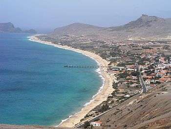 Cal Islet (far left), view from Porto Santo | |
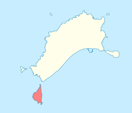 Location within the Municipality of Porto Santo | |
| Geography | |
|---|---|
| Location | Atlantic Ocean |
| Coordinates | 33°00′32″N 16°23′13″W / 33.0089°N 16.3869°WCoordinates: 33°00′32″N 16°23′13″W / 33.0089°N 16.3869°W |
| Total islands | 1 |
| Area | 1.40 km2 (0.54 sq mi) |
| Highest elevation | 178 m (584 ft) |
| Concelhos (Municipalities) | Porto Santo |
| Demographics | |
| Population | 0 |
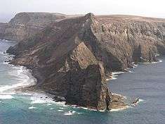
Cal Islet (Portuguese: Ilhéu da Cal, also: Ilheú de Baixo) is a small island about 500 m (1,600 ft) south of Porto Santo Island, in the Madeira Islands Archipelago, Portugal. With an area of 1.40 km2 (0.54 sq mi),[1] Cal is the largest of six islets close to Porto Santo. The highest point is 178 m (584 ft).[2] The islet has never been inhabited. At one time lime was mined on Cal.[2] Endemic fauna includes the land snails Amphorella cimensis[3] and Leiostyla relevata.[4]
Cal Islet
References
- ↑ m@pas online, Direção-Geral do Território
- 1 2 Porto Santo – História
- ↑ D. Teixeira; et al. (2016). "Amphorella cimensis". IUCN Red List of Threatened Species. Version 2018-1. International Union for Conservation of Nature. Retrieved 2018-10-05.
- ↑ M.B. Seddon (2010). "Leiostyla relevata". IUCN Red List of Threatened Species. Version 2018-1. International Union for Conservation of Nature. Retrieved 2018-10-05.
External links
This article is issued from
Wikipedia.
The text is licensed under Creative Commons - Attribution - Sharealike.
Additional terms may apply for the media files.