Cahuita
| Cahuita | |
|---|---|
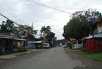 Main street in Cahuita | |
 Cahuita Location of Cahuita in Costa Rica | |
| Coordinates: 9°44′20″N 82°50′44″W / 9.73889°N 82.84556°W | |
| Country |
|
| Province |
|
| Canton | Talamanca |
| Government | |
| • Type | Democratic |
| • Syndic | Adenyl Guillermo Peralta Cruz (PLN) |
| • Substitutle syndic | vacant |
| Area | |
| • Total | 235.64 km2 (90.98 sq mi) |
| Elevation(city center) | 6 m (20 ft) |
| Population | |
| • Total | 8,293 |
| Time zone | UTC-6 (Central Standard Time) |
| • Summer (DST) | UTC-6 (No DST) |
| Postal code | 70403 |
| Area code(s) | + 506 |
| Google Earth[1] | |
Cahuita is a small city located on the Caribbean coast of Costa Rica, in the Talamanca Canton of Limón Province. Cahuita is the capital of the Cahuita District.
Culture and nearby attractions
Due to its proximity to the Caribbean shoreline, Cahuita is renowned for Afro-Caribbean influence on dining and local culture. The city is specifically known for its beaches, dessert crepes (often including local bananas, strawberries, and chocolate), and variations of grilled chicken. The Playa Negra (Black Beach) and Cahuita National Park are close to town. Limón is north of Cahuita. Puerto Viejo is the next town south.
Road conditions
Cahuita is served by National Route 36, which connects Puerto Limón to Sixaola. Many roads in Cahuita are composed of dirt, gravel, and stone, often making it necessary for foreign visitors to rent a 4WD vehicle to reach local beaches and hotels on the northern fringes of town.
Climate
Cahuita has a tropical climate. Temperatures remain consistent during the year. Sunrise and sunset change very little during the year (about 6:00 AM and 6:00 PM, respectively). Limón International Airport is nearby and has similar average temperatures and precipitation.
| Climate data for Limon International Airport, Costa Rica | |||||||||||||
|---|---|---|---|---|---|---|---|---|---|---|---|---|---|
| Month | Jan | Feb | Mar | Apr | May | Jun | Jul | Aug | Sep | Oct | Nov | Dec | Year |
| Average high °F (°C) | 80 (27) |
80 (27) |
82 (28) |
83 (28) |
83 (28) |
83 (28) |
82 (28) |
82 (28) |
84 (29) |
83 (28) |
81 (27) |
80 (27) |
81.9 (27.7) |
| Average low °F (°C) | 71 (22) |
71 (22) |
72 (22) |
73 (23) |
75 (24) |
75 (24) |
74 (23) |
74 (23) |
75 (24) |
75 (24) |
73 (23) |
72 (22) |
73.3 (22.9) |
| Average precipitation inches (mm) | 12.56 (319) |
7.90 (200.7) |
7.61 (193.3) |
11.30 (287) |
11.08 (281.4) |
10.87 (276.1) |
16.06 (407.9) |
11.37 (288.8) |
6.42 (163.1) |
7.80 (198.1) |
14.45 (367) |
15.81 (401.6) |
133.23 (3,384) |
| Source: Weather Underground [2] | |||||||||||||
See also
References
| Wikivoyage has a travel guide for Cahuita. |
- ↑ Google Earth
- ↑ "Weather for Limon International Airport". Weather Underground.