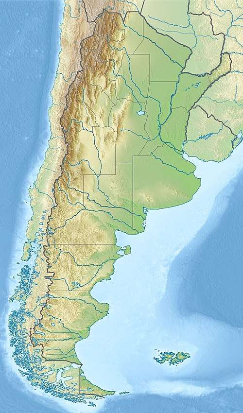
Cabo Corrientes, Mar del Plata
| Cabo Corrientes | |
|---|---|
|
View of Cabo Corrientes from the Varese beach | |
 | |
| Location | Mar del Plata, General Pueyrredón Partido, Buenos Aires Province, Argentina |
| Coordinates | 38°01′00″S 57°31′27″W / 38.016599°S 57.524278°WCoordinates: 38°01′00″S 57°31′27″W / 38.016599°S 57.524278°W |
| Offshore water bodies | Atlantic Ocean |
Cabo Corrientes (Cape Currents) is a rocky outcrop on the Argentine coast between the Chica and Varese beaches in Mar del Plata, in the extreme southeast of Buenos Aires Province, on the Argentine Sea of the Atlantic Ocean. It is located at the geographical coordinates 38°01′S 57°32′W / 38.017°S 57.533°W.
Cabo Corrientes was originally called Cabo de las Dos Corrientes (Cape of the Two Currents), since it is the point where a warm current from the tropical coast of Brazil (Brazil Current) converges with a current of frigid water from the Antarctic (Falklands Current).
History
Admiral William Brown anchored at Cabo Corrientes in early January 1826 waiting for ships from Carmen de Patagones, which he would transfer to the Río de la Plata in mid-January and to participate in the naval campaign of the Cisplatine War. The national government had sent him to the aid of Buenos Aires because it had been blockaded on 21 December 1825 by a powerful squadron from the Brazilian Empire under the command of Vice Admiral Rodrigo José Ferreira de Lobo.[1]
Pioneers slowly populated the region, including the lands of the cape. During the Freemen of the South movement they were defeated in the Battle of Chascomús on 7 November 1839 by the Federales. Most of the settlers and officers fled to the coast at Samborombón Bay. Thanks to a message from the landowner Gervasio Ortiz de Rozas, fifth brother of Juan Manuel de Rosas and among the conspirators who had not participated in the movement, the French blockading squadron approached the coast where the rebels could embark for Montevideo. As a consequence the government of Juan Manuel de Rosas confiscated their cattle, goods and lands.
In 1847 the philanthropic landowner José Gregorio de Lezama took advantage of the situation in the Buenos Aires campaign and paid a low price for the confiscated lands of Ladislao Martínez Castro of Buenos Aires, among them the "Laguna de los Padres" ranch to the northwest of Cabo Corrientes near the old Jesuit mission of Our Lady of the Pillar that had operated from 13 November 1746 to 1 September 1751. In 1850 he also bought the "Harmony" ranch, and in 1852 the "San Julián de Vivoratá" ranch.

José Gregorio de Lezama sold the three ranches in August 1856[lower-alpha 1] to a Portuguese-Brazilian society consisting of Irineu Evangelista de Sousa, Viscount of Mauá, who kept 50%, the other half being evenly divided between Sa de Pereira, Pereira de Faria, Figueredo and the Portuguese José Coelho de Meyrelles, consul of the Kingdom of Portugal in Buenos Aires, who was put in charge of managing the ranches and establishing the first saladero in the present Mar del Plata streets of Pedro Luro Avenue and Santiago del Estero in Cabo de las Corrientes, which formed the base of the future city of Mar del Plata.[lower-alpha 2][1][lower-alpha 3][2]
Footnotes
- ↑ According to the newspaper El Nacional of 14 August 1856 Meyrelles, a Portuguese person, had just acquired the lands of the Laguna de los Padres.
- ↑ According to the Archives of the Department of Geodesy, Measure No. 1 of the General Pueyrredón Partido and No. 4 of Mar Chiquita Partido, Ministry of Public Works of the Province of Buenos Aires.
- ↑ According to the Según el Archivo Histórico de la Provincia de Buenos Aires
Notes
- 1 2 Crowder et al. 2005, p. 131.
- ↑ Halperín Donghi, p. 30.
Sources
- Crowder, Patricia; Isla, Fededico I.; Denegri, Guillermo; Farías, Alberto; Cermelo, Leonardo (2005), Mar del Plata: Fragilidad Costera, Argentina: MARTIN - Universidad Nacional de Mar del Plata
- Halperín Donghi, Tulio, La expansión ganadera en la campaña
External links
- "Cabo Corrientes", geonames.org, retrieved 2017-06-25