Còpia de Palomes
| Còpia de Palomes | |
|---|---|
 | |
| Highest point | |
| Elevation | 837 m (2,746 ft) |
| Prominence | 100 m (330 ft) |
| Coordinates | 41°39′35″N 1°36′10″E / 41.65972°N 1.60278°ECoordinates: 41°39′35″N 1°36′10″E / 41.65972°N 1.60278°E |
| Geography | |
 Còpia de Palomes Location in the Pyrenees | |
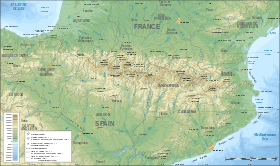
| Location | Anoia, Catalonia, Spain |
| Parent range | Serra de Rubió |
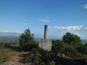
Còpia de Palomes is a mountain of Catalonia, Spain. It has an elevation of 837 metres (2,740 ft) above sea level. It is situated to the municipality of Rubió, to the comarca of the Anoia, province of Barcelona.[1] It is the highest mountain of the Serra de Rubió.[2]
The usual route until the peak begins to the Refugi Mas del Tronc, that has a lasted of three hours between going and go back and a length of 2 kilometres. The route to the peak is very easy and in fact almost can arrive in car. [3]
References
- ↑ Enciclopèdia.cat. "Còpia de Palomes" (in Catalan). Retrieved 2015-09-02.
- ↑ "Altitudes obtained of the Cartographic Institute of Catalonia".
- ↑ Rutes Serra de Rubió. "Route to the mountain" (in Catalan). Retrieved 2015-09-02.
This article is issued from
Wikipedia.
The text is licensed under Creative Commons - Attribution - Sharealike.
Additional terms may apply for the media files.