Càrn Mòr Dearg
| Càrn Mòr Dearg | |
|---|---|
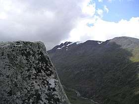 Càrn Mòr Dearg: seen from Aonach Mor | |
| Highest point | |
| Elevation | 1,223 m (4,012 ft) [1] |
| Prominence | 165 m (541 ft) |
| Parent peak | Ben Nevis |
| Listing | Munro, Marilyn |
| Naming | |
| Translation | Great red peak (Gaelic) |
| Pronunciation |
Scottish Gaelic: [ˈkʰaːrˠn ˈmoːɾ ˈtʲɛɾɛk] English approximation: KARN-mor-JERR-ek |
| Geography | |
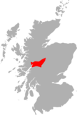
| Location | Lochaber, Scotland |
| OS grid | NN177722 |
| Topo map | OS Landranger 41 |
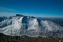
Càrn Mòr Dearg (1,221 m (4,006 ft)) is the eighth-highest mountain in Scotland. It is situated in the west of Scotland, close to the town of Fort William, in Lochaber, Highland. It lies just to the north-west of its much more famous neighbour, Ben Nevis, to which it is linked by the spectacular Càrn Mòr Dearg Arête.
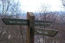
The ascent of Càrn Mòr Dearg from the north (start from the North Face Car Park), the traverse of the arête, and the scramble up the north side of Ben Nevis make one of the best horse-shoe routes in Scotland.[2]
Snow Sports
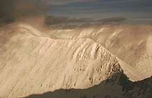
Càrn Mòr Dearg is attractive to ski mountaineers and off piste skiers and boarders. In good conditions the summit can be reached from the nearby Nevis Range Ski areas in two hours or less. With enough snow, the descent from the summit to the CIC Hut gives a long, pleasant grade 1 descent. The eastern flank of the mountain has three fine bowls which give descents graded between 2 and 5 in K. Biggin's guide.[3]
See also
References
- ↑ "walkhighlands Carn Mor Dearg". walkhighlands.co.uk. 2013. Retrieved 22 November 2013.
- ↑ Irvine Butterfield (1986). The High Mountains of Britain and Ireland. London: Diadem Books. p. 98. ISBN 0-906371-71-6.
- ↑ Kenny Biggin, Scottish Offpiste Skiing and Snowboarding : Nevis Range and Ben Nevis (Spean Bridge : Skimountain, 2013)97-105.
External links
| Wikivoyage has a travel guide for Ledge Route and the Carn Mor Dearg Arete. |
| Wikimedia Commons has media related to Càrn Mòr Dearg. |
 | Nevis range | 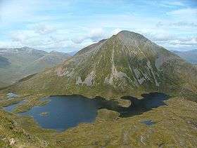 | |
|---|---|---|---|
| Mamores | |||
| Grey Corries |
| ||
| Alder/Ardverikie |
| ||
| Ossian/Treig |
| ||
Coordinates: 56°48′20″N 4°59′15″W / 56.80549°N 4.98744°W