Buttsbury
| Buttsbury | |
|---|---|
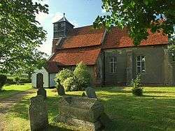 St. Mary's church | |
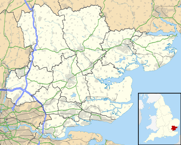 Buttsbury Buttsbury shown within Essex | |
| OS grid reference | TQ6698 |
| Civil parish | |
| Shire county | |
| Region | |
| Country | England |
| Sovereign state | United Kingdom |
| Post town | Billericay |
| Post town | Ingatestone |
| Police | Essex |
| Fire | Essex |
| Ambulance | East of England |
| EU Parliament | East of England |
Buttsbury is a village and former 2,079-acre (8.4 km2) civil parish (once ancient parish) in the Chelmsford District of Essex, England, a contraction of Botulph's Pirie, a major saint who died in 680.[1] It is sometimes surmised that the name refers to a tree under which St Botolph preached.[2] The civil parish was merged into Stock in 1936.[3] In 1931 the civil parish had a population of 1709.[4]
Location
It is centred on minor roads between the towns of Ingatestone and Billericay. The parish technically starts immediately north of the old centre of Billericay and extends around the south, west and north sides of Stock.[5]
History
The land of Buttsbury has since the early medieval period been mainly agricultural, with some remaining areas of woodland. Of working adult men, in 1831, 84, a clear majority, worked in agriculture. The other three working sectors were: manufacturing: nil, retail and handicraft: 43 and other: 13.[6] This remained the situation by 1881, by which time 18 of the women residents were domestic servants.[7]
| Wheat | 288 |
| Barley | 37 |
| Oats | 173 |
| Potatoes | 16 |
| Peas | 95 |
| Beans | 60 |
| Turnips or Rape | 11 |
| Rye | 7 |
In the early 1870s Buttsbury had 531 residents divided across 109 houses.[1] A wave of early 20th century building was coupled with better general health especially lower infant mortality rates. Between 1911 and 1921 the population rose from 697 to 863, notwithstanding World War I in that period. In the following ten years it rose to 1,709.[9]
| Year | Houses[10] |
|---|---|
| 1831 | 106 |
| 1841 | 123 |
| 1851 | 121 |
| 1881 | 119 |
| 1891 | 123 |
| 1901 | 136 |
| 1921 | 201 |
| 1931 | 467 |
References
- 1 2 http://www.visionofbritain.org.uk/place/6566
- ↑ Eilert Ekwall. The Concise Oxford Dictionary of English Place Names. 4th ed.
- ↑ "Relationships and changes Buttsbury AP/CP through time". Vision of Britain. Retrieved 30 January 2018.
- ↑ "Population Statistics Ridlington AP/CP through time". Vision of Britain. Retrieved 30 January 2018.
- ↑ http://www.visionofbritain.org.uk/unit/10235777/boundary
- ↑ http://www.visionofbritain.org.uk/unit/10235777/cube/OCC_PAR1831_SIMP
- ↑ http://www.visionofbritain.org.uk/unit/10235777/cube/OCC_ORDER1881
- ↑ http://www.visionofbritain.org.uk/unit/10235777/cube/CROP1801
- ↑ http://www.visionofbritain.org.uk/unit/10235777/cube/TOT_POP
- ↑ http://www.visionofbritain.org.uk/unit/10235777/cube/HOUSES
External links
| Wikimedia Commons has media related to Buttsbury. |
Towns, villages and hamlets of the City of Chelmsford | ||
|---|---|---|
| ||
| Towns | ||
| Villages and hamlets |
| |