Bungo-ōno
| Bungo-ōno 豊後大野市 | |||
|---|---|---|---|
| City | |||
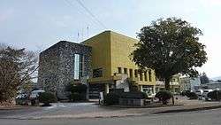 Bungo-ōno City Office | |||
| |||
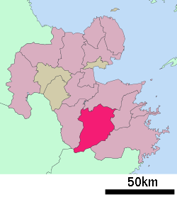 Location of Bungo-ōno in Ōita Prefecture | |||
 Bungo-ōno Location in Japan | |||
| Coordinates: 32°59′N 131°35′E / 32.983°N 131.583°ECoordinates: 32°59′N 131°35′E / 32.983°N 131.583°E | |||
| Country | Japan | ||
| Region | Kyushu | ||
| Prefecture | Ōita Prefecture | ||
| Government | |||
| • Mayor | Fumitoshi Kawano (since April 2017) | ||
| Area | |||
| • Total | 603.36 km2 (232.96 sq mi) | ||
| Population (March 1, 2017) | |||
| • Total | 35,811 | ||
| • Density | 59/km2 (150/sq mi) | ||
| Symbols | |||
| • Tree | Quercus acutissima | ||
| • Flower | Phoney cherry | ||
| Time zone | UTC+9 (JST) | ||
| City hall address |
1200 Mie-cho Ichiba, Bungo-ono-shi, Oita-ken 879-7198 | ||
| Website |
www | ||


Bungo-ōno (豊後大野市 Bungo-ōno-shi) is a city located in Ōita Prefecture, Japan.
The modern city of Bungo-ōno was established on March 31, 2005, from the merger between the towns of Asaji, Inukai, Mie, Ogata and Ōno, and the villages of Chitose and Kiyokawa (all from Ōno District).
As of March 1, 2017, the city has an estimated population of 35,811 and a population density of 59 persons per km².[1] The total area is 603.36 km².
In 2012, the growing deer population began to greatly affect the shiitake mushroom farming industry.[2]
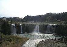
Harajiri Waterfall
References
- ↑ "Official website of Bungo-ōno city" (in Japanese). Japan: Bungo-ōno City. Retrieved 21 April 2017.
- ↑ "If the Japanese Diet Included Deer, It might Keep Wolves from the Door". Wall Street Journal. December 28, 2012.
External links
| Wikimedia Commons has media related to Bungo-ōno, Ōita. |
- Bungo-ōno City official website (in Japanese)
| Core city | ||
|---|---|---|
| Cities | ||
| Districts | ||
This article is issued from
Wikipedia.
The text is licensed under Creative Commons - Attribution - Sharealike.
Additional terms may apply for the media files.