Buffalo Township, Union County, Pennsylvania
| Buffalo Township, Union County, Pennsylvania | |
|---|---|
| Township | |
 There are many dairy farms like this in Buffalo Township | |
 Map of Union County, Pennsylvania highlighting Buffalo Township | |
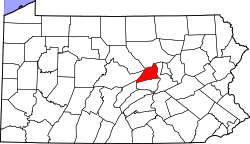 Map of Pennsylvania highlighting Union County | |
| Country | United States |
| State | Pennsylvania |
| County | Union |
| Settled | 1770 |
| Incorporated | 1772 |
| Area[1] | |
| • Total | 30.33 sq mi (78.56 km2) |
| • Land | 30.13 sq mi (78.04 km2) |
| • Water | 0.20 sq mi (0.52 km2) 0% |
| Population (2010) | |
| • Total | 3,538 |
| • Estimate (2016)[2] | 3,639 |
| • Density | 120.77/sq mi (46.63/km2) |
| Time zone | UTC-5 (EST) |
| • Summer (DST) | UTC-4 (EDT) |
| FIPS code | 42-119-10016 |
Buffalo Township is a township in Union County, Pennsylvania, United States of America. The population was 3,207 at the 2000 census.
History
The Buffalo Presbyterian Church was added to the National Register of Historic Places in 1976.[3]
Geography
According to the United States Census Bureau, the township has a total area of 30.6 square miles (79 km2), all of it land.
Buffalo Township is bordered by White Deer Township to the north, Kelly Township to the east and north, Lewisburg to the east, East Buffalo Township to the south and east, Limestone Township to the south and west, and West Buffalo Township to the west.
Demographics
| Historical population | |||
|---|---|---|---|
| Census | Pop. | %± | |
| 2010 | 3,538 | — | |
| Est. 2016 | 3,639 | [2] | 2.9% |
| U.S. Decennial Census[4] | |||
As of the census[5] of 2000, there were 3,207 people, 1,166 households, and 895 families residing in the township. The population density was 104.8 people per square mile (40.5/km²). There were 1,215 housing units at an average density of 39.7/sq mi (15.3/km²). The racial makeup of the township was 97.85% White, 0.56% African American, 0.09% Native American, 0.25% Asian, 0.03% Pacific Islander, 0.37% from other races, and 0.84% from two or more races. Hispanic or Latino of any race were 0.97% of the population.
There were 1,166 households out of which 35.1% had children under the age of 18 living with them, 66.6% were married couples living together, 7.0% had a female householder with no husband present, and 23.2% were non-families. 21.0% of all households were made up of individuals and 10.5% had someone living alone who was 65 years of age or older. The average household size was 2.73 and the average family size was 3.18.
In the township the population was spread out with 29.2% under the age of 18, 7.1% from 18 to 24, 26.5% from 25 to 44, 22.4% from 45 to 64, and 14.8% who were 65 years of age or older. The median age was 36 years. For every 100 females, there were 103.7 males. For every 100 females age 18 and over, there were 94.8 males.
The median income for a household in the township was $37,539, and the median income for a family was $42,222. Males had a median income of $31,121 versus $21,315 for females. The per capita income for the township was $18,764. About 8.4% of families and 10.5% of the population were below the poverty line, including 16.1% of those under age 18 and 6.6% of those age 65 or over.
Government
Buffalo Township is governed by three elected supervisors. Meetings are held on the first Monday of each month at 6:30 pm at the Buffalo Township Municipal Building 2115 Strickler Road, Mifflinburg, Pennsylvania, 17844.
Buffalo Township Polling places are:
- BUFFALO I - Buffalo Township Building, 2115 Strickler Rd., Mifflinburg, PA 17844
- BUFFALO II - Youth Center, 3150 New Berlin Mountain Road, Lewisburg, Pennsylvania, 17837
- The Union County Election Calendar follows the state's calendar. Voter registration can be obtained at the Union County Election Voter Registration Department, Union County Government Center, 155 N. 15th Street, Lewisburg, PA. 17837
There is a Planning Commission is made up of seven appointees. They meet the last Monday of the month at 7:00 p.m. at the Township Building.
There are two polling places (voting) in the township:
- Buffalo Township 1 is located in the Buffalo Township Municipal Building, 2115 Strickler Rd., Mifflinburg.
- Buffalo Township 2 is located in Youth Center, 3150 New Berlin Mountain Road, Lewisburg, PA. 17837
Villages
References
- ↑ "2016 U.S. Gazetteer Files". United States Census Bureau. Retrieved Aug 14, 2017.
- 1 2 "Population and Housing Unit Estimates". Retrieved June 9, 2017.
- ↑ National Park Service (2010-07-09). "National Register Information System". National Register of Historic Places. National Park Service.
- ↑ "Census of Population and Housing". Census.gov. Retrieved June 4, 2016.
- ↑ "American FactFinder". United States Census Bureau. Archived from the original on 2013-09-11. Retrieved 2008-01-31.
Municipalities and communities of Union County, Pennsylvania, United States | ||
|---|---|---|
| Boroughs | | |
| Townships | ||
| CDPs | ||
| Unincorporated communities | ||
Coordinates: 40°57′00″N 76°58′59″W / 40.95000°N 76.98306°W