Buena Vista Charter Township, Michigan
| Buena Vista Charter Township, Michigan | |
|---|---|
| Charter township | |
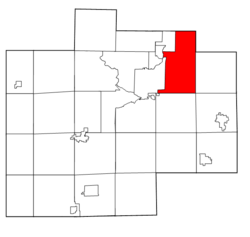 Location within Saginaw County, Michigan | |
| Coordinates: 43°25′56″N 83°52′59″W / 43.43222°N 83.88306°WCoordinates: 43°25′56″N 83°52′59″W / 43.43222°N 83.88306°W | |
| Country | United States |
| State | Michigan |
| County | Saginaw |
| Government | |
| • Type | Board-manager |
| • Supervisor | Christina L. Dillard |
| • Township Superintendent | Torrie McAfee |
| Area | |
| • Total | 36.2 sq mi (93.8 km2) |
| • Land | 36.0 sq mi (93.2 km2) |
| • Water | 0.2 sq mi (0.6 km2) |
| Elevation | 584 ft (178 m) |
| Population (2010) | |
| • Total | 8,676 |
| • Density | 286.7/sq mi (110.7/km2) |
| Time zone | UTC-5 (Eastern (EST)) |
| • Summer (DST) | UTC-4 (EDT) |
| FIPS code | 26-11560[1] |
| GNIS feature ID | 1626000[2] |
| Website | bvct.org |
Buena Vista Charter Township is a charter township of Saginaw County in the U.S. state of Michigan. The 2000 Census placed the township population at 10,318. The 2010 Census places the population at 8,676.[3]
History
This area was known to the Ojibwe as Tik-wak-baw-hawning.[4]
On July 30, 2013, the Saginaw Intermediate School District Board of Trustees officially dissolved Buena Vista School District with its area split up between three other districts: Bridgeport-Spaulding Community School District (135 students), Saginaw City School District (260) or Frankenmuth School District.[5]
Communities
- Buena Vista is a census-designated place (CDP) and unincorporated community in the township.[6]
- Crow Island is an unincorporated community in the township on Crow Island Road between M-13 and Hack Road.[7][8] A post office opened February 6, 1882, and closed March 13, 1883. The office was reestablished May 3, 1883, until closing on March 15, 1895.[9]
- Fifield was a settlement with a railroad station on the Pere Marquette Railroad. It was centered around a sawmill and had a post office from 1898 until 1900.[10]
- Robin Glen-Indiantown is a census-designated place (CDP) in the township containing the unincorporated community of Indiantown.[7][11]
Geography
According to the United States Census Bureau, the township has a total area of 36.2 square miles (94 km2), of which 36.0 square miles (93 km2) is land and 0.2 square miles (0.52 km2) (0.63%) is water.
Demographics
As of the census[1] of 2000, there were 10,318 people, 3,870 households, and 2,743 families residing in the township. The population density was 286.7 per square mile (110.7/km²). There were 4,211 housing units at an average density of 117.0 per square mile (45.2/km²). The racial makeup of the township was 37.00% White, 55.57% African American, 0.46% Native American, 0.13% Asian, 0.01% Pacific Islander, 4.30% from other races, and 2.53% from two or more races. Hispanic or Latino of any race were 9.11% of the population.
There were 3,870 households out of which 35.1% had children under the age of 18 living with them, 39.2% were married couples living together, 27.2% had a female householder with no husband present, and 29.1% were non-families. 24.6% of all households were made up of individuals and 8.6% had someone living alone who was 65 years of age or older. The average household size was 2.61 and the average family size was 3.10.
In the township the population was spread out with 30.3% under the age of 18, 8.7% from 18 to 24, 26.9% from 25 to 44, 21.8% from 45 to 64, and 12.3% who were 65 years of age or older. The median age was 33 years. For every 100 females, there were 92.4 males. For every 100 females age 18 and over, there were 84.8 males.
The median income for a household in the township was $30,339, and the median income for a family was $32,851. Males had a median income of $30,625 versus $22,775 for females. The per capita income for the township was $15,636. About 19.7% of families and 20.4% of the population were below the poverty line, including 31.6% of those under age 18 and 11.4% of those age 65 or over.
Government
The township is governed under a modified Council–manager government where the township manager only takes over most of the duties of the supervisor.
References
Notes
- 1 2 "American FactFinder". United States Census Bureau. Archived from the original on 2013-09-11. Retrieved 2008-01-31.
- ↑ U.S. Geological Survey Geographic Names Information System: Buena Vista Charter Township, Michigan
- ↑ "Buena Vista Township Statistics". United States Census Bureau. Retrieved 2009-08-03.
- ↑ History of Saginaw County, Michigan (Chicago: Charles C. Chapman & Co., 1881) p. 772
- ↑ Burns, Candace. (July 31, 2013) SISD officially dissolves Buena Vista schools Archived 2014-08-18 at the Wayback Machine.. ABC12. Retrieved on August 16, 2013.
- ↑ U.S. Geological Survey Geographic Names Information System: Buena Vista, Michigan
- 1 2 Saginaw County Map. J. Shively. State of Michigan Department of Information Technology Technology Center for Geographic Information. September 2007.
- ↑ U.S. Geological Survey Geographic Names Information System: Crow Island, Michigan
- ↑ U.S. Geological Survey Geographic Names Information System: Crow Island Post Office (historical)
- ↑ Romig 1986, p. 196.
- ↑ U.S. Geological Survey Geographic Names Information System: Indiantown, Michigan
Sources
- Romig, Walter (October 1, 1986) [1973]. Michigan Place Names: The History of the Founding and the Naming of More Than Five Thousand Past and Present Michigan Communities. Great Lakes Books Series (Paperback). Detroit, Michigan: Wayne State University Press. ISBN 0-8143-1838-X. ISBN 978-0814318386.
External links
Municipalities and communities of Saginaw County, Michigan, United States | ||
|---|---|---|
| Cities | 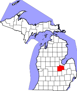 | |
| Villages | ||
| Charter townships | ||
| General law townships | ||
| CDPs | ||
| Other communities |
| |
| Footnotes | ‡This populated place also has portions in an adjacent county or counties | |