Buckland, Tasmania
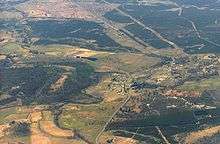
Buckland is a village on the Tasman Highway in Tasmania, Australia. It contains a historic church, St John the Baptist church. At the 2006 census, Buckland had a population of 193.[1]
History
The area around Buckland was originally settled around 1820. It was called the Prosser Plains as it was near the Prosser River. The oldest remaining house dates from 1826, and is called Woodsden. The village was renamed Buckland by the then governor, John Franklin in 1846, gaining its name from William Buckland the Dean of Westminster. The Buckland hotel was built in 1845.[2]
Prosser's Plains Post Office opened on 19 October 1838, was renamed Buckland around 1884 and closed in 1981.[3]
The St John the Baptist Church foundation stone was laid on 22 August 1846 by Fitzherbert Adams Marriott the arch deacon of Hobart. The foundation stone has an inscription that reads: "That God may in this place be glorified, and the prayers and praises of the faithful continually offered until Christ shall come again". However the inscription is now on the inside of the wall.[4]
On 19 June 2007 black ice caused numerous vehicle accidents in the Buckland area.[5]
The Buckland timber mill operated from 1948 till 1981.[4]
Notes
- ↑ Australian Bureau of Statistics (25 October 2007). "Buckland (State Suburb)". 2006 Census QuickStats. Retrieved 31 October 2011.
- ↑ "Buckland". The Age. 2004-02-08.
- ↑ Premier Postal History. "Post Office List". Premier Postal Auctions. Retrieved 16 June 2012.
- 1 2 Kathryn Stansbie. "A History of Prosser Plains". Orford Primary School. Archived from the original on 17 October 2009. Retrieved 2010-01-15.
- ↑ "Tasman Highway still blocked". ABC. 2007-06-19. Retrieved 2010-01-15.
References
- Parish of Buckland Tasmania : Church of St. John the Baptist : history of church and window booklet from 1973
- Buckland Soil Map from Tasmanian Department of Primary Industry Water and Environment Hobart 2000
- Louisa A. Meredith Buckland Church & Parsonage, Prosser's Vale print from Our island home : a Tasmanian sketchbook J. Walch & Sons Hobart 1879
- Karlie Walker (1998). "The Town of Buckland". Retrieved 2010-01-13.
Coordinates: 42°36′28″S 147°43′01″E / 42.60778°S 147.71694°E