Browns Bay, New Zealand
| Browns Bay | |
|---|---|
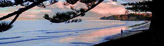
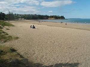
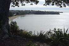 Browns Bay and the beach from above. | |
| Basic information | |
| Local authority | Auckland Council |
| Electoral ward |
Albany ward (Hibiscus and Bays Local Board) |
| Population | 3,978 (2006) |
| Surrounds | |
| North | Waiake |
| Northeast | (Hauraki Gulf) |
| East | (Hauraki Gulf) |
| Southeast | (Hauraki Gulf) |
| South | Rothesay Bay |
| Southwest | Murrays Bay |
| West | Northcross |
| Northwest | Torbay Heights |
Browns Bay is an Auckland suburb in the East Coast Bays area.
Browns Bay is under the local governance of the Auckland Council, and is located in the Albany ward, one of thirteen administrative areas in the council.
The population was 3,978 in the 2006 census, an increase of 282 from 2001.[1]
History
Peter Brown, after whom the bay is named, bought 136 acres of bush and scrub there in 1876.[2] He built his house on what is now the corner of Clyde Road and Anzac Road. This house was destroyed by fire in 1930. He also built a manager's residence in 1886 overlooking his land (now Freyberg Park) at 33 Glencoe Road. This house still exists and is believed to be the oldest existing house in East Coast Bays.
Education
Browns Bay School is a contributing primary (years 1-6) school with a decile rating of 10 and a roll of 639.[3] The school was established in 1888.[4]
The Corelli School of the Arts is a composite (years 1-13) school with a roll of 78.[5] It is a private school which runs specialist programs in visual arts, music, drama and dance as well as the general curriculum.[6]
Sport and recreation
The East Coast Bays Barracudas rugby league club is based in Browns Bay.
Notes
The Browns Bay Magazine is run by the local business association.
- ↑ Quickstats about Browns Bay
- ↑ Verran, David. "Our history, East Coast Bays (Part one)". Albany & East Coast Bays News. Retrieved 2012-12-19.
- ↑ Te Kete Ipurangi schools database: Browns Bay School
- ↑ "Browns Bay School". Retrieved 2009-01-11.
- ↑ Te Kete Ipurangi schools database: Corelli Arts School
- ↑ "Private School Review Report: The Corelli School". Education Review Office. November 2007.
External links
- http://www.brownsbay.org.nz Official Browns Bay Website
- Google Maps: Browns Bay (satellite photograph)
Coordinates: 36°42′55″S 174°45′00″E / 36.7152°S 174.7500°E