Brookshire, Texas
| Brookshire, Texas | |
|---|---|
| City | |
 Brookshire, Texas welcome sign. | |
 Location of Brookshire, Texas | |
| Coordinates: 29°47′1″N 95°57′16″W / 29.78361°N 95.95444°WCoordinates: 29°47′1″N 95°57′16″W / 29.78361°N 95.95444°W | |
| Country | United States |
| State | Texas |
| County | Waller |
| Government | |
| • Mayor | Eric Scott |
| Area | |
| • Total | 3.5 sq mi (9.1 km2) |
| • Land | 3.5 sq mi (9.1 km2) |
| • Water | 0.0 sq mi (0.0 km2) |
| Elevation | 161 ft (49 m) |
| Population (2010) | |
| • Total | 4,702 |
| Time zone | UTC-6 (Central (CST)) |
| • Summer (DST) | UTC-5 (CDT) |
| ZIP code | 77423 |
| Area code(s) | 281/346/713/832 |
| FIPS code | 48-10636[1] |
| GNIS feature ID | 1331324[2] |
| Website | Brookshire, Texas Official Website |
Brookshire is a city in Waller County, a part of the Houston–The Woodlands–Sugar Land metropolitan area.
Location
Brookshire is located 34 miles west of downtown Houston along Interstate 10, 7 miles west of Katy, the fastest-growing residential region in the U.S. It is part of the Interstate 10 Energy Corridor, part of the west Houston and Katy market, and a member of West I-10 Chamber of Commerce. Igloo Industries has a 2 million ft2 cooler factory just east of Brookshire and Rooms To Go recently completed a 2.5 million ft2 distribution warehouse and showroom at the intersection of I-10 and Woods Road, just east of Brookshire. The population was 4702 as of the 2010 census, a growth rate of 36% since the 2000 census.
Brookshire was named in honor of Nathan Brookshire, who was a large land owner in the vicinity and a leading resident. He was a captain in the Texian Army and participated in the storming and capture of Bexar in 1835. In 1893, John Kellner donated land and filed a plat for the Town of Kellner out of the William Cooper Survey, one of the oldest headrights in the state. Also in 1893, John Brookshire and O. C. Drew filed their plat for the Town of Brookshire out of the H. H. Pennington Survey. On May 24, 1946, the City of Brookshire was incorporated, comprising both the Kellner and the Brookshire/Drew plats.
Geography
Brookshire is located at 29°47′1″N 95°57′16″W / 29.78361°N 95.95444°W (29.783737, -95.954325).[3]
According to the United States Census Bureau, the city has a total area of 3.5 square miles (9.1 km²), all of it land.
Demographics
| Historical population | |||
|---|---|---|---|
| Census | Pop. | %± | |
| 1950 | 1,015 | — | |
| 1960 | 1,339 | 31.9% | |
| 1970 | 1,683 | 25.7% | |
| 1980 | 2,175 | 29.2% | |
| 1990 | 2,922 | 34.3% | |
| 2000 | 3,450 | 18.1% | |
| 2010 | 4,702 | 36.3% | |
| Est. 2016 | 5,233 | [4] | 11.3% |
| U.S. Decennial Census | |||
As of the 2010 U.S. Census, the population of Brookshire was 4702, a 36% growth rate since the 2000 census. As of the census[1] of 2000, 3,450 people, 1,138 households, and 823 families resided in the city. The population density was 983.2 people per square mile (379.5/km²). The 1,257 housing units averaged 358.2 per square mile (138.3/km²). The racial makeup of the city was 32.67% White, 38.20% African American, 0.58% Native American, 0.38% Asian, 0.03% Pacific Islander, 26.09% from other races, and 2.06% from two or more races. Hispanics or Latinos of any race were 37.16% of the population.
Of the 1,138 households, 40.2% had children under the age of 18 living with them, 44.5% were married couples living together, 21.2% had a female householder with no husband present, and 27.6% were not families; 23.6% of all households were made up of individuals, and 8.7% had someone living alone who was 65 years of age or older. The average household size was 3.03 and the average family size was 3.56.
In the city, the population was distributed as 32.4% under the age of 18, 11.7% from 18 to 24, 30.6% from 25 to 44, 17.3% from 45 to 64, and 8.0% who were 65 years of age or older. The median age was 28 years. For every 100 females, there were 97.3 males. For every 100 females age 18 and over, there were 92.7 males.
The median income for a household in the city was $29,461, and for a family was $32,017. Males had a median income of $25,032 versus $18,674 for females. The per capita income for the city was $12,235. About 14.5% of families and 18.7% of the population were below the poverty line, including 24.1% of those under age 18 and 8.1% of those age 65 or over.
Government and infrastructure
The mayor of Brookshire is Eric Scott, who was elected May 11, 2013, re-elected by a landslide on May 9, 2015, and then re-elected for a third term on May 6, 2017.
The Brookshire Katy Drainage District has its headquarters in Brookshire.[5]
West Engineering Services has its world headquarters in Brookshire.
The United States Postal Service operates the Brookshire Post Office at 4115 5th Street.[6]
Economy
Goya Foods has its Texas offices in an unincorporated area near Brookshire.[7]
Education
The City of Brookshire is served by the Royal Independent School District. The district operates Royal Early Childhood Center, Royal Elementary School, Royal Middle School, and Royal High School. It also has two schools of choice, Royal STEM Academy and Royal Early College High School.
Brazos Valley Sudbury School was located near Brookshire.
References
- 1 2 "American FactFinder". United States Census Bureau. Archived from the original on 2013-09-11. Retrieved 2008-01-31.
- ↑ "US Board on Geographic Names". United States Geological Survey. 2007-10-25. Retrieved 2008-01-31.
- ↑ "US Gazetteer files: 2010, 2000, and 1990". United States Census Bureau. 2011-02-12. Retrieved 2011-04-23.
- ↑ "Population and Housing Unit Estimates". Retrieved June 9, 2017.
- ↑ "Contact BKDD." Brookshire Katy Drainage District. Retrieved on July 17, 2010.
- ↑ "Post Office Location - BROOKSHIRE." United States Postal Service. Retrieved on December 4, 2008.
- ↑ "Contact Us Archived 2011-04-24 at the Wayback Machine.." Goya Foods. Retrieved on March 26, 2016. "Goya Foods of Texas 30602 McAllister Road Brookshire, TX 77423"
External links
- Brookshire, Texas Official Website
- Brookshire, Texas from the Handbook of Texas Online
Municipalities and communities of Waller County, Texas, United States | ||
|---|---|---|
| Cities | 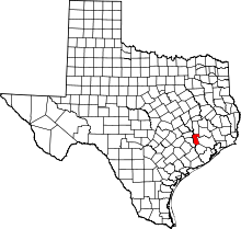 | |
| Town | ||
| Unincorporated communities | ||
| Footnotes | ‡This populated place also has portions in an adjacent county or counties | |