Broadbent, Oregon
| Broadbent, Oregon | |
|---|---|
| Unincorporated community | |
 Broadbent  Broadbent | |
| Coordinates: 43°00′32″N 124°08′47″W / 43.00889°N 124.14639°WCoordinates: 43°00′32″N 124°08′47″W / 43.00889°N 124.14639°W | |
| Country | United States |
| State | Oregon |
| County | Coos |
| Elevation | 79 ft (24 m) |
| Time zone | UTC-8 (Pacific (PST)) |
| • Summer (DST) | UTC-7 (PDT) |
| ZIP code | 97414 |
| Area code(s) | 541 |
| GNIS feature ID | 1118090[1] |
| Coordinates and elevation from Geographic Names Information System | |
Broadbent is an unincorporated community in Coos County, Oregon, United States.[1] Broadbent is on Oregon Route 542 south of Myrtle Point along the South Fork Coquille River.[2] Broadbent has a post office with ZIP code 97414.[3]
The community was named after C. E. Broadbent, who built a cheese factory here. The Coos Bay Line of the Southern Pacific Railway opened a station at Broadbent in 1915. The local post office opened on August 19, 1916.[4]
Climate
This region experiences warm (but not hot) and dry summers, with no average monthly temperatures above 71.6 °F (22.0 °C). According to the Köppen Climate Classification system, Broadbent has a warm-summer Mediterranean climate, abbreviated "Csb" on climate maps.[5]
References
- 1 2 "Broadbent". Geographic Names Information System. United States Geological Survey. November 28, 1980. Retrieved December 28, 2016.
- ↑ Oregon Atlas and Gazetteer (Map) (7th ed.). Yarmouth, Maine: DeLorme Mapping. 2008. p. 52. ISBN 978-0-89933-347-2.
- ↑ "Broadbent, Oregon". Look Up a ZIP Code. United States Post Office. Retrieved December 28, 2016.
- ↑ McArthur, Lewis A.; McArthur, Lewis L. (2003) [1928]. Oregon Geographic Names (7th ed.). Portland, Oregon: Oregon Historical Society Press. p. 113. ISBN 978-0875952772.
- ↑ "Broadbent, Oregon". Weatherbase. CantyMedia. Retrieved December 28, 2016.
Municipalities and communities of Coos County, Oregon, United States | ||
|---|---|---|
| Cities | 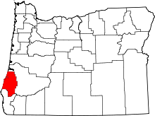 | |
| CDPs | ||
| Unincorporated communities | ||
| Ghost town | ||
| Indian reservations | ||
| Footnotes | ‡This populated place also has portions in an adjacent county or counties | |
This article is issued from
Wikipedia.
The text is licensed under Creative Commons - Attribution - Sharealike.
Additional terms may apply for the media files.