Brisco, British Columbia
| Brisco | |
|---|---|
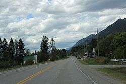 Downtown Brisco on BC Highway 95 | |
 Brisco Location of Brisco in British Columbia | |
| Coordinates: 50°49′37″N 116°16′12″W / 50.8269975°N 116.269968°WCoordinates: 50°49′37″N 116°16′12″W / 50.8269975°N 116.269968°W | |
| Country |
|
| Province |
|
| Time zone | UTC-7 (MST) |
| • Summer (DST) | UTC-6 (MDT) |
| Postal code | V0A 1B0 |
| Area code(s) | 250, 778 |
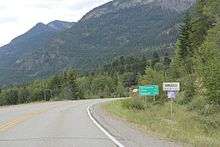
Entering Brisco on British Columbia Highway 95
Brisco is an unincorporated community in the East Kootenay region of British Columbia along the Upper Columbia River. It has a post office that opened on 20 January 1955[1] with the postal code V0A 1B0. British Columbia Highway 95 passes through the community.[2]
References
- ↑ "BC Geographical Names". BC Geographical Names database. Retrieved 5 March 2015.
- ↑ "Location of Brisco, BC". Google Maps. Retrieved 5 March 2015.
This article is issued from
Wikipedia.
The text is licensed under Creative Commons - Attribution - Sharealike.
Additional terms may apply for the media files.