Brierley Hill Urban District
| Brierley Hill District of Brierley Hill | |
|---|---|
| Urban District | |
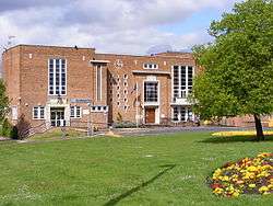 Former Brierley Hill Civic Centre, now Brierley Hill Police Station | |
| Area | |
| • 1911 | 1,016 acres (4 km2)[1] |
| • 1961 | 5,851 acres (24 km2)[2] |
| Area transferred | |
| • 1934 | 4,246 acres (17 km2)[3] from Kingswinford Rural District |
| • 1934 | 666 acres (3 km2)[3] from Quarry Bank Urban District |
| Population | |
| • 1911 | 12,263[4] |
| • 1961 | 56,075[4] |
| History | |
| • Preceded by | Sanitary district |
| • Origin | Local Government Act 1894 |
| • Created | 1894 |
| • Abolished | 1966 |
| • Succeeded by |
County Borough of Dudley Metropolitan Borough of Dudley |
| Status | Urban District |
| Government | Brierley Hill District Council |
| • Type | Urban District Council |
| • HQ | Civic Centre, Brierley Hill |
| • Motto |
Sine labore nihil floret (Latin) "Without labour nothing prospers" |
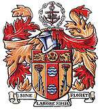 Arms of Brierley Hill District Council | |
| Contained within | |
| • County | Staffordshire |
Brierley Hill Urban District was a former Urban District in Staffordshire, England, comprising the areas of Brierley Hill, Kingswinford, Quarry Bank, and Pensnett, now within the modern-day Dudley Metropolitan Borough in the West Midlands county.
Brierley Hill became an urban district in 1894 under the Local Government Act. Previously, it had been an urban sanitory authority within the parish of Kingswinford. It was greatly expanded in 1934, when it took in the Quarry Bank and Kingswinford districts. It remained an independent urban district until 1966, when it was merged into the Dudley County Borough[3] under the advice of the Local Government Commission for England.
References
- ↑ "1911 Census - Population". A Vision of Britain through Time. GB Historical GIS/University of Portsmouth. Retrieved 15 April 2017.
- ↑ "1961 Census of England and Wales, County Report". A Vision of Britain through Time. GB Historical GIS/University of Portsmouth. Retrieved 15 April 2017.
- 1 2 3 "Brierley Hill UD through time - Census tables with data for the Local Government District". A Vision of Britain through Time. GB Historical GIS/University of Portsmouth. Retrieved 15 April 2017.
- 1 2 "Brierley Hill UD through time - Population Statistics". A Vision of Britain through Time. GB Historical GIS/University of Portsmouth. Retrieved 15 April 2017.
Coordinates: 52°28′48″N 2°07′19″W / 52.48°N 2.122°W
| Ancient boroughs | ||
|---|---|---|
| Incorporated boroughs | ||
| Urban districts |
| |
| Rural districts |
| |
| Civil parishes | ||
This article is issued from
Wikipedia.
The text is licensed under Creative Commons - Attribution - Sharealike.
Additional terms may apply for the media files.