Brenne (river)
| Brenne | |
|---|---|
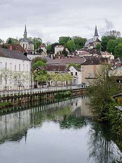 The Brenne at Montbard | |
| Country | France |
| Physical characteristics | |
| Main source | Bourgogne |
| River mouth |
Armançon 47°18′50″N 4°42′36″E / 47.31389°N 4.71000°ECoordinates: 47°18′50″N 4°42′36″E / 47.31389°N 4.71000°E |
| Length | 71.7 km (44.6 mi) |
| Basin features | |
| Progression | Armançon→ Yonne→ Seine→ English Channel |
The Brenne is a 71.7-kilometre (44.6 mi) river in Côte-d'Or in Bourgogne, eastern France.[1] It rises in Sombernon and flows generally northwest to join the Armançon at Buffon, 6 kilometres (4 mi) downstream from Montbard.[1]
References
- 1 2 "Fiche cours d'eau - La Brenne (F33-0400)" (in French). SANDRE. Retrieved 1 April 2012.
This article is issued from
Wikipedia.
The text is licensed under Creative Commons - Attribution - Sharealike.
Additional terms may apply for the media files.