Branston and Mere
.jpg)
Branston and Mere is a civil parish in the North Kesteven district of Lincolnshire, England. It is situated some 4 miles (6 km) roughly south-east from the city and county town of Lincoln.[1]
The parish is a long strip between the RAF airfield at Waddington and the River Witham near Bardney. The A15 road crosses the extreme west and the parish is bisected by the Sleaford to Lincoln railway line[2]
In the 2001 Census the population of the parish (including Branston Booths) was recorded as 4019 in 1693 households,[3] increasing to 4,095 in 1,823 households at the 2011 census.[4]
The civil parish was created in 1931, by merging the two former parishes of Branston and Mere.[5]
Geography
The parish (Branston and Mere) meets Heighington and Canwick around 330 yards (300 m) north of the school, towards Heighington. The parish boundary with Heighington passes close to the edge of the east of the village, skirting the school's playing fields. The boundary follows Moor Lane, across the railway line along the road to Branston Booths where it meets the B1190 and Car Dyke, and along the Branston Delph on Branston Fen, crossing the River Witham, becoming the North Kesteven and West Lindsey boundary. The section north-east of the Witham is called Branston Island, meeting Fiskerton, Stainfield and Bardney, passing Bardney Lock. It meets Potter Hanworth at Bardney Bridge and follows Branston Causeway (becomes the B1190) westwards, skirting the north edge of Potterhanworth Booths. It follows the B1202 westwards for around a half mile, then skirts the southern edge of a wood, crosses the railway line and Little Gate Lane, then Sleaford Road (B1188).[2]
It meets Nocton west of Fox Covert, and crosses Bloxholm Lane at the point where Branston Lane crosses, and meets Waddington halfway between Bloxholm Lane and the A15. Mere Hall is around a mile to the north. It crosses the A15 220 yards (200 m) south of the B1178 junction, and passing through the eastern section of the airfield. The boundary passes northwards through RAF Waddington, with the north-eastern section of the runway in the parish. It crosses the A15 at the northern edge of RAF Waddington, just off the point where it meets Bracebridge Heath. It follows Bloxholm Lane to the north, and skirts the northern part of Westfield Farm, where it meets Canwick. It crosses the B1188 where the pylons cross the road. 440 yards (400 m) east it meets Washingborough, following a small beck and skirting the north edge of the village.[2]
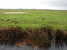
The western end of the parish is on the high ground of the Lincolnshire Limestone while the eastern end is closer to sea level, the historic marshes of the River Witham.[2]
Places in the parish
Branston and Mere today comprises:[2]
Settlements

Other locations
.jpg)

- Branston Island 53°13′24″N 0°21′23″W / 53.2234°N 0.3563°W An irregular shaped bit of land, separated from the rest of the parish by the River Witham, enclosed by the old and new courses of that river.
- Mere 53°10′29″N 0°29′23″W / 53.174774°N 0.489611°W Former medieval village of Mere, the name preserved in the names of Mere House, Mere Hall, and Mere Lane.[2][6]
- Branston Hall 53°11′39″N 0°28′55″W / 53.194229°N 0.481892°W Former Stately home and Hospital, now a Hotel.[2]
- Longhills Hall 53°11′21″N 0°27′05″W / 53.189028°N 0.451467°W Large country house.[2]
References
- ↑ "Branston and Mere parish council". Lincolnshire county council. Retrieved 23 November 2013.
- 1 2 3 4 5 6 7 8 Lincoln: Sleaford, Metheringham & Navenby (Map) (A1 ed.). 1:25 000. OS Explorer. Ordnance survey of Great Britain. 3 April 2006. § 272. ISBN 9780319238202.
- ↑ "Neighbourhood statistics". 2001 census. Office for national statistics. Retrieved 20 April 2013.
- ↑ "Civil parish population 2011". Neighbourhood Statistics. Office for National Statistics. Retrieved 23 April 2016.
- ↑ "Branston and Mere CP through time, Census tables with data for the Parish-level Unit,". A Vision of Britain through Time. GB Historical GIS / University of Portsmouth. Retrieved 23 November 2013.
- ↑ Historic England. "Mere (349384)". PastScape. Retrieved 20 November 2013.
- Google (5 September 2013). "Parish Outline" (Map). Google Maps. Google. Retrieved 5 September 2013.
External links

- Branston in the Domesday Book
- "all 41 historical records for the parish". Pastscape. English Heritage.
England Portal | |
| Unitary authorities | |
| Boroughs or districts | |
| Major settlements |
|
| Topics | |