Brandenberger Ache
| Brandenberger Ache | |
|---|---|
 | |
| Physical characteristics | |
| Main source | Spitzingsee, Bavaria |
| River mouth |
Inn 47°26′48″N 11°53′52″E / 47.4468°N 11.8977°ECoordinates: 47°26′48″N 11°53′52″E / 47.4468°N 11.8977°E |
| Length | 37.8 km (23.5 mi) [1] |
| Basin features | |
| Progression | Inn→ Danube→ Black Sea |
| Basin size | 283 km2 (109 sq mi) [1] |
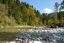
The Brandenberger Ache (in Bavaria: Valepp) is a river of Bavaria, Germany, and the Kufstein District, Austria. It is a 38 km long left tributary of the Inn. It starts as the outflow of the Spitzingsee in southern Bavaria, and flows from North to South to the town of Rattenberg where it merges with the Inn.
References
- 1 2 Complete table of the Bavarian Waterbody Register by the Bavarian State Office for the Environment (xls, 10.3 MB)
This article is issued from
Wikipedia.
The text is licensed under Creative Commons - Attribution - Sharealike.
Additional terms may apply for the media files.