Boys Ranch, Texas
| Boys Ranch | |
|---|---|
| Unincorporated community & census-designated place | |
 Boys Ranch Location within the state of Texas  Boys Ranch Boys Ranch (the US) | |
| Coordinates: 35°32′0″N 102°15′13″W / 35.53333°N 102.25361°WCoordinates: 35°32′0″N 102°15′13″W / 35.53333°N 102.25361°W | |
| Country | United States |
| State | Texas |
| County | Oldham |
| Area | |
| • Total | 1.6 sq mi (4.1 km2) |
| • Land | 1.6 sq mi (4.1 km2) |
| • Water | 0.0 sq mi (0.0 km2) |
| Elevation | 3,186 ft (971 m) |
| Population (2010) | |
| • Total | 282 |
| • Density | 180/sq mi (69/km2) |
| Time zone | UTC-6 (Central (CST)) |
| • Summer (DST) | UTC-5 (CDT) |
| ZIP codes | 79010 |
| Area code(s) | 806 |
| GNIS feature ID | 1352792 |
Boys Ranch is a census-designated place and unincorporated community in northeastern Oldham County, Texas, United States, on the site of the original county seat, Tascosa. It lies along U.S. Route 385 northeast of the city of Vega, the county seat of Oldham County.[1] Although Boys Ranch is unincorporated, it has a post office, with the ZIP code of 79010.[2] This was a new CDP for the 2010 census with a population of 282. [3]
Geography
Boys Ranch is located at 35°32′0″N 102°15′13″W / 35.53333°N 102.25361°W (35.533189, -102.253684). The CDP has a total area of 1.6 square miles (4.1 km2), all land.[4] Its elevation is 3,186 feet (971 m).[5]
Education
Boys Ranch is served by the Boys Ranch Independent School District, containing Boys Ranch High School, Mimi Farley Elementary, and Blakemore Middle School.
Climate
According to the Köppen Climate Classification system, Boys Ranch has a semi-arid climate, abbreviated "BSk" on climate maps.[6]
Demographics
The racial makeup of the city was 100.0% White. In terms of ancestry, 58.0% were of German, 23.3% were of Swiss, 14.4% were of Dutch, 8.0% were of British, 5.8% were of Swedish
See also
References
- ↑ Rand McNally. The Road Atlas '08. Chicago: Rand McNally, 2008, p. 98.
- ↑ Zip Code Lookup Archived June 15, 2011, at the Wayback Machine.
- ↑ "Population and Housing Unit Counts, 2010 Census of Population and Housing" (PDF). Texas: 2010.
- ↑ "Boys Ranch, Texas :: Boundary Map of Boys Ranch, Texas".
- ↑ U.S. Geological Survey Geographic Names Information System: Boys Ranch, Texas
- ↑ Climate Summary for Boys Ranch, Texas
Municipalities and communities of Oldham County, Texas, United States | ||
|---|---|---|
| Cities | 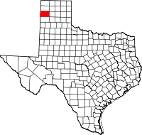 | |
| CDP | ||
| Unincorporated community | ||
| Ghost towns | ||