Box, Oklahoma
| Box, Oklahoma | |
|---|---|
| Unincorporated community | |
 Box, Oklahoma  Box, Oklahoma | |
| Coordinates: 35°34′52″N 94°58′35″W / 35.58111°N 94.97639°WCoordinates: 35°34′52″N 94°58′35″W / 35.58111°N 94.97639°W | |
| Country | United States |
| State | Oklahoma |
| County | Sequoyah |
| Area[1] | |
| • Total | 3.304 sq mi (8.56 km2) |
| • Land | 3.290 sq mi (8.52 km2) |
| • Water | 0.014 sq mi (0.04 km2) |
| Elevation | 919 ft (280 m) |
| Population (2010)[1] | |
| • Total | 224 |
| • Density | 68/sq mi (26/km2) |
| Time zone | UTC-6 (Central (CST)) |
| • Summer (DST) | UTC-5 (CDT) |
| Area code(s) | 918 & 539 |
| GNIS feature ID | 1100229[2] |
Box is an unincorporated community and census-designated place in Sequoyah County, Oklahoma, United States. Its population was 224 as of the 2010 census.[1] Oklahoma State Highway 82 passes through the community.
Box was previously known as Roy; its post office changed its name to Box on July 7, 1911, after resident Henry Box. The post office closed on February 29, 1928.[3]
Geography
According to the U.S. Census Bureau, the community has an area of 3.304 square miles (8.56 km2); 3.290 square miles (8.52 km2) of its area is land, and 0.014 square miles (0.036 km2) is water.[1]
References
- 1 2 3 4 "2010 Census Gazetteer Files - Places: Oklahoma". U.S. Census Bureau. Retrieved March 6, 2017.
- ↑ "Box". Geographic Names Information System. United States Geological Survey.
- ↑ Shirk, George H. (1974). Oklahoma Place Names (2 ed.). Norman, Oklahoma: University of Oklahoma Press. p. 30. ISBN 0806111402.
Municipalities and communities of Sequoyah County, Oklahoma, United States | ||
|---|---|---|
| City | 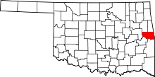 | |
| Towns | ||
| CDPs | ||
| Unincorporated communities | ||
This article is issued from
Wikipedia.
The text is licensed under Creative Commons - Attribution - Sharealike.
Additional terms may apply for the media files.