Bowmore, North Carolina
| Bowmore, North Carolina | |
|---|---|
| Census-designated place | |
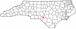 Location of Bowmore, North Carolina | |
| Coordinates: 34°56′6″N 79°18′0″W / 34.93500°N 79.30000°WCoordinates: 34°56′6″N 79°18′0″W / 34.93500°N 79.30000°W | |
| Country | United States |
| State | North Carolina |
| County | Hoke |
| Area | |
| • Total | 3.3 sq mi (8.6 km2) |
| • Land | 3.3 sq mi (8.6 km2) |
| • Water | 0.0 sq mi (0.0 km2) |
| Elevation | 259 ft (79 m) |
| Population (2010) | |
| • Total | 103 |
| • Density | 31/sq mi (12.0/km2) |
| Time zone | UTC-5 (Eastern (EST)) |
| • Summer (DST) | UTC-4 (EDT) |
| FIPS code | 37-07400[1] |
| GNIS feature ID | 0981776[2] |
Bowmore is an unincorporated community and census-designated place (CDP) in Hoke County, North Carolina, United States. The population was 103 at the 2010 census.[3]
Geography
Bowmore is located in southwestern Hoke County at 34°56′6″N 79°18′0″W / 34.93500°N 79.30000°W (34.935023, -79.299938),[4] along U.S. Route 401, which leads northeast 5 miles (8 km) to Raeford, the county seat, and southwest the same distance to Wagram.
According to the United States Census Bureau, the Bowmore CDP has a total area of 3.3 square miles (8.6 km2), all of it land.[3]
Demographics
As of the census[1] of 2000, there were 145 people, 60 households, and 42 families residing in the CDP. The population density was 43.2 people per square mile (16.7/km²). There were 73 housing units at an average density of 21.7/sq mi (8.4/km²). The racial makeup of the CDP was 22.07% White, 57.93% African American, 18.62% Native American, 1.38% from other races. Hispanic or Latino of any race were 2.07% of the population.
There were 60 households out of which 38.3% had children under the age of 18 living with them, 45.0% were married couples living together, 18.3% had a female householder with no husband present, and 30.0% were non-families. 26.7% of all households were made up of individuals and 5.0% had someone living alone who was 65 years of age or older. The average household size was 2.42 and the average family size was 2.93.
In the CDP, the population was spread out with 25.5% under the age of 18, 9.7% from 18 to 24, 27.6% from 25 to 44, 24.8% from 45 to 64, and 12.4% who were 65 years of age or older. The median age was 38 years. For every 100 females, there were 116.4 males. For every 100 females age 18 and over, there were 111.8 males.
The median income for a household in the CDP was $39,125, and the median income for a family was $48,250. Males had a median income of $30,156 versus $16,000 for females. The per capita income for the CDP was $13,807. There were none of the families and 4.2% of the population living below the poverty line, including no under eighteens and none of those over 64.
References
- 1 2 "American FactFinder". United States Census Bureau. Archived from the original on 2013-09-11. Retrieved 2008-01-31.
- ↑ "US Board on Geographic Names". United States Geological Survey. 2007-10-25. Retrieved 2008-01-31.
- 1 2 "Geographic Identifiers: 2010 Census Summary File 1 (G001): Bowmore CDP, North Carolina". American Factfinder. U.S. Census Bureau. Retrieved December 21, 2017.
- ↑ "US Gazetteer files: 2010, 2000, and 1990". United States Census Bureau. 2011-02-12. Retrieved 2011-04-23.
Municipalities and communities of Hoke County, North Carolina, United States | ||
|---|---|---|
| City | 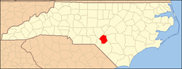 | |
| Town | ||
| CDPs | ||
| Military base | ||
| Footnotes | ‡This populated place also has portions in an adjacent county or counties | |