Bourges Airport
| Bourges Airport Aéroport de Bourges | |||||||||||||||
|---|---|---|---|---|---|---|---|---|---|---|---|---|---|---|---|
| Summary | |||||||||||||||
| Airport type | Public | ||||||||||||||
| Operator | CCI du Cher | ||||||||||||||
| Serves | Bourges, France | ||||||||||||||
| Elevation AMSL | 529 ft / 161 m | ||||||||||||||
| Coordinates | 47°03′39″N 002°22′12″E / 47.06083°N 2.37000°ECoordinates: 47°03′39″N 002°22′12″E / 47.06083°N 2.37000°E | ||||||||||||||
| Maps | |||||||||||||||
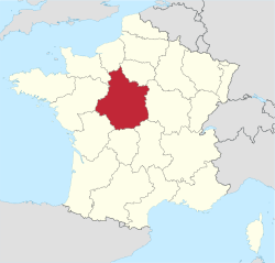 Location of Centre-Val de Loire region in France | |||||||||||||||
 LFLD Location of airport in Centre-Val de Loire region | |||||||||||||||
| Runways | |||||||||||||||
| |||||||||||||||
Bourges Airport (French: Aéroport de Bourges[2]) (IATA: BOU[5], ICAO: LFLD) is an airport serving Bourges, a commune in the Cher department[1] of the Centre-Val de Loire region of France. It is located 3 km (1.6 NM) southwest of Bourges.[1]
Facilities
Bourges Airport resides at an elevation of 529 feet (161 m) above mean sea level. It has an asphalt paved runway designated 06/24 which measures 1,550 by 45 metres (5,085 ft × 148 ft) and a parallel grass runway measuring 915 by 60 metres (3,002 ft × 197 ft).[1][2]
References
- 1 2 3 4 LFLD – Bourges. AIP from French Service d'information aéronautique, effective 13 September 2018.
- 1 2 3 "Aéroport de Bourges (BOU / LFLD)" (in French). Union des Aéroports Français. Archived from the original on 24 February 2010. Retrieved 13 May 2010.
- ↑ Airport information for LFLD from DAFIF (effective October 2006)
- ↑ Airport information for BOU at Great Circle Mapper. Source: DAFIF (effective October 2006).
- ↑ "Bourges Airport (BOU / LFLD)". Aviation Safety Network. Retrieved 13 May 2010.
External links
This article is issued from
Wikipedia.
The text is licensed under Creative Commons - Attribution - Sharealike.
Additional terms may apply for the media files.