Boretto
| Boretto | |
|---|---|
| Comune | |
| Comune di Boretto | |
 Boretto Location of Boretto in Italy | |
| Coordinates: 44°54′N 10°33′E / 44.900°N 10.550°ECoordinates: 44°54′N 10°33′E / 44.900°N 10.550°E | |
| Country | Italy |
| Region | Emilia-Romagna |
| Province | Province of Reggio Emilia (RE) |
| Area | |
| • Total | 19.2 km2 (7.4 sq mi) |
| Population (31 December 2016) | |
| • Total | 5,293 |
| • Density | 280/km2 (710/sq mi) |
| Time zone | UTC+1 (CET) |
| • Summer (DST) | UTC+2 (CEST) |
| Postal code | 42022 |
| Dialing code | 0522 |
Boretto (Reggiano: Borèt) is a comune (municipality) in the Province of Reggio Emilia in the Italian region Emilia-Romagna, located about 80 kilometres (50 mi) northwest of Bologna and about 25 kilometres (16 mi) northwest of Reggio Emilia. As of 31 December 2016, it had a population of 5,293 and an area of 19.2 square kilometres (7.4 sq mi).[1]
Boretto borders the following municipalities: Brescello, Castelnovo di Sotto, Gualtieri, Pomponesco, Poviglio, Viadana.
Among the churches is the Basilica Minore of San Marco and Santa Croce.
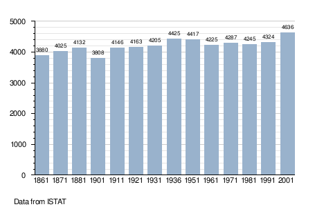
Demographic evolution
External links
References

This article is issued from
Wikipedia.
The text is licensed under Creative Commons - Attribution - Sharealike.
Additional terms may apply for the media files.