Bordelonville, Louisiana
| Bordelonville, Louisiana | |
|---|---|
| CDP | |
 Bordelonville Location within the state of Louisiana | |
| Coordinates: 31°6′21″N 91°54′27″W / 31.10583°N 91.90750°WCoordinates: 31°6′21″N 91°54′27″W / 31.10583°N 91.90750°W | |
| Country | United States |
| State | Louisiana |
| Parishes | Avoyelles |
| Area | |
| • Total | 4.4 sq mi (11.3 km2) |
| • Land | 4.4 sq mi (11.3 km2) |
| • Water | 0 sq mi (0 km2) |
| Elevation | 52 ft (16 m) |
| Population (2010) | |
| • Total | 525 |
| • Density | 121/sq mi (46.6/km2) |
| Time zone | UTC-6 (Central (CST)) |
| • Summer (DST) | UTC-5 (CST) |
| ZIP code | 71320 |
| FIPS code | 22-08745 |
Bordelonville is a census-designated place (CDP) in Avoyelles Parish, Louisiana, United States.[1] As of the 2010 census, it had a population of 525.[2]
Bordelonville is located along Bayou des Glaises and Louisiana Highway 451, 17 miles (27 km) east of Marksville, the parish seat.
Etymology
Bordelonville was named for Remi Bordelon, who was instrumental in getting the town a post office.[3]
References
- ↑ "Bordelonville, Louisiana". Geographic Names Information System. United States Geological Survey.
- ↑ "Geographic Identifiers: 2010 Demographic Profile Data (G001): Bordelonville CDP, Louisiana". U.S. Census Bureau, American Factfinder. Retrieved May 21, 2013.
- ↑ Leeper, Clare D'Artois (19 October 2012). Louisiana Place Names: Popular, Unusual, and Forgotten Stories of Towns, Cities, Plantations, Bayous, and Even Some Cemeteries. LSU Press. p. 44. ISBN 978-0-8071-4740-5.
Municipalities and communities of Avoyelles Parish, Louisiana, United States | ||
|---|---|---|
| Cities | 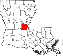 | |
| Towns | ||
| Villages | ||
| CDPs | ||
| Other Unincorporated communities | ||
| Indian reservation | ||
This article is issued from
Wikipedia.
The text is licensed under Creative Commons - Attribution - Sharealike.
Additional terms may apply for the media files.