Borchgrevink Nunatak
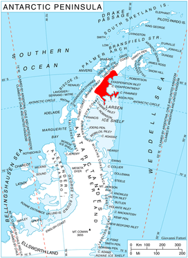
Location of Oscar II Coast on Antarctic Peninsula.
Borchgrevink Nunatak (66°3′S 62°30′W / 66.050°S 62.500°WCoordinates: 66°3′S 62°30′W / 66.050°S 62.500°W) is a nunatak 1.5 nautical miles (3 km) long which rises to 650 metres (2,130 ft), standing at the south side of the entrance to Richthofen Pass, on the east coast of Graham Land. It was discovered in 1902 by the Swedish Antarctic Expedition under Otto Nordenskiöld, who named it for C.E. Borchgrevink, leader of the British Antarctic Expedition, 1898–1900, to Victoria Land.[1]
References
- ↑ "Borchgrevink Nunatak". Geographic Names Information System. United States Geological Survey. Retrieved 2011-08-02.
![]()
This article is issued from
Wikipedia.
The text is licensed under Creative Commons - Attribution - Sharealike.
Additional terms may apply for the media files.