Boița
| Boița | |
|---|---|
| Commune | |
 Boița Location of Boița | |
| Coordinates: 45°37′59″N 24°15′27″E / 45.63306°N 24.25750°ECoordinates: 45°37′59″N 24°15′27″E / 45.63306°N 24.25750°E | |
| Country |
|
| County | Sibiu County |
| Status | Commune |
| Government | |
| • Mayor | Roman Toader (Social Democratic Party) |
| Area | |
| • Total | 100.37 km2 (38.75 sq mi) |
| Population (2011) | |
| • Total | 1,367 |
| • Density | 19.5/km2 (51/sq mi) |
| Time zone | UTC+2 (EET) |
| • Summer (DST) | UTC+3 (EEST) |
| Postal Code | 555701 |
| Website | |
Boița (German: Ochsendorf; Hungarian: Bojca; Latin: Caput Stenarum) is a commune in Sibiu County, Transylvania, Romania, at the foothills of the Cindrel Mountains, 22 km south of the county capital Sibiu, in the Mărginimea Sibiului ethnographic area, on the main road between Sibiu and the southern part of Romania, the National road 7/European route 81, at the entrance of the Olt River defile. The commune is composed of four villages: Boița, Lazaret, Lotrioara (Latorvár) and Paltin. These were part of Tălmaciu town until 2004, when they were split off.
In 1910 the village had 1,657 inhabitants.
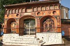
Boița church gate
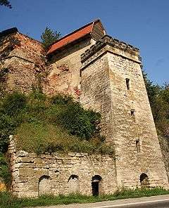
The old customs tower in Boița
See also

References
This article is issued from
Wikipedia.
The text is licensed under Creative Commons - Attribution - Sharealike.
Additional terms may apply for the media files.