Boherbue
| Boherbue An Bóthar Buí 2018 Duhallow Junior Football Champions | |
|---|---|
| Village | |
| Nickname(s): Boher | |
 Boherbue Location in Ireland | |
| Coordinates: 52°09′N 9°04′W / 52.150°N 9.067°W | |
| Country | Ireland |
| Province | Munster |
| County | County Cork |
| Elevation | 800 ft (200 m) |
| Population (2016)[1] | |
| • Total | 334 |
| Time zone | UTC+0 (WET) |
| • Summer (DST) | UTC-1 (IST (WEST)) |
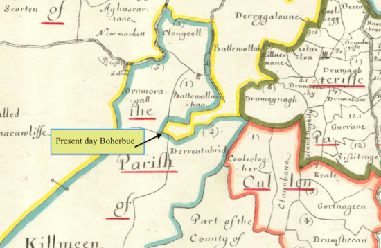
Boherbue (post office spelling) or Boherboy (Ordnance Survey spelling) (Irish: An Bóthar Buí, meaning "the yellow road")[2] is a village in North West County Cork, Ireland. It is in the civil parish of Kilmeen in the Barony of Duhallow.
History
The exact time period for the first permanent settlement in the area in not known. It has been suggested that the first inhabitants of the area were probably nomadic due to the amount of ‘forts and bailes’, and Fulacht fiadhs, that are still seen in the area. A permanent settlement was described as early as 1655 in William Petty’s map of County Cork. In the 17th century the wider areas of Pobal Uí Chaoimh and Sliabh Luachra were being opened up by the construction of roadways, which facilitated the movement of cattle and general economic growth.[3] During this time a roadway from Kanturk to Killarney was constructed which passed through present day Boherbue.
Origin of name
Several theories exist as to how the area came to be known as Bóthar Buí. Bóthar Buí literally translated from Irish means ‘yellow road’, and many maintain that the name comes from the yellow mud that used to come to the surface of the road in times of rain.[4] Another theory suggests that the name comes the pagan god or chief Druid Baoí, who is said to have lived in the area.[5] Yet another explanation is that name originates from the abundant yellow gorse bushes (known locally as ‘furze’) that grow in the area.[6]
Transport and communications
Boherbue lies on the R577 road, linking Tralee and Mallow.
By rail
Closest rail link to Boherbue is Millstreet (12km) and Banteer (15km) train stations, Mallow train station 32km away is also popular to use in the area because of more frequent Cork-Dublin services there
By air
Boherbue's closest airports are Kerry Airport (37km), Cork Airport (70km) and Shannon Airport (103km)
Education
Local children are educated at primary level in Boherbue National School and secondary level at Boherbue Comprehensive School which lies to the east of the village and has approximately 45 teachers and 360 pupils.
Religion
The original parish church was situated evidently where Kilmeen graveyard is today. The present parish church is situated in the east end of the village. It is a beautiful, well kept, modern-type building, erected in 1969 by local contractor Christy Feehan and blessed and opened by the then Bishop of Kerry, Dr Moynihan, on April 29th. 1969.[7]
Sport
Boherbue's main sport is Gaelic Football represented by Boherbue GAA club with the football field situated in Gneeves at the western end of the village on the Knocknagree road. (L1108)
As of 2018 Boherbue juvenile footballers have merged with Knocknagree to form BK Plunketts, the name Plunkett is of honour of the founder of the Co-operative movement Horace Plunkett
Boherbue is also represented in Ladies Football, Boherbue LFC used to represent the area until they merged with the Ballydesmond and Kiskeam club Araglin Desmonds, therefore renaming Araglin Desmonds Buí to represent Boherbue
Boherbue National School and Boherbue Comprehensive School both compete in school championships in Football and Hurling
Handball is also played in Boherbue.[8]
References
- ↑ "Census 2016 - Small Area Population Statistics (SAPMAP Area) - Settlements - Boherbue". Census 2016. Central Statistics Office.
- ↑ Placenames Database of Ireland. An Bóthar Buí Verified 2011-02-09.
- ↑ McCarthy, Louis (2012). Boherbue Village 'Historical survey from earliest times to present day'. I.R.D. Duhallow. p. 10.
- ↑ McCarthy, Louis (2012). Boherbue Village 'Historical survey from earliest times to present day'. I.R.D. Duhallow. p. 7.
- ↑ McCarthy, Louis (2012). Boherbue Village 'Historical survey from earliest times to present day'. I.R.D. Duhallow. p. 7.
- ↑ McCarthy, Louis (2012). Boherbue Village 'Historical survey from earliest times to present day'. I.R.D. Duhallow. p. 7.
- ↑ McCarthy, Louis. "The Parish of Kilmeen". Retrieved 22 November 2014.
- ↑ "Katie and Shane bring home handball gold". Boherbue GAA Club. Archived from the original on 2013-12-24. Retrieved 2012-08-22.
External links
Coordinates: 52°09′N 9°04′W / 52.150°N 9.067°W