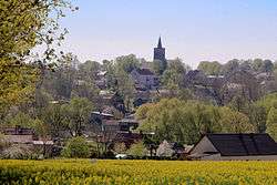
Boguchwałów
| Boguchwałów | |
|---|---|
 | |
 Boguchwałów | |
| Coordinates: 50°8′45″N 17°54′29″E / 50.14583°N 17.90806°ECoordinates: 50°8′45″N 17°54′29″E / 50.14583°N 17.90806°E | |
| Country |
|
| Voivodeship | Opole |
| County | Głubczyce County |
| Gmina | Gmina Baborów |
| Time zone | UTC+1 (CET) |
| • Summer (DST) | UTC+2 (CEST) |
| Area code(s) | +48 77 |
| Car plates | OGL |
Boguchwałów [bɔɡuxfawuf] (German: Hohndorf), is a village in Opole Voivodeship, Głubczyce County, Gmina Baborów.[1] It lies approximately 6 kilometres (4 mi) west of Baborów, 8 km (5 mi) south-east of Głubczyce, and 58 km (36 mi) south of the regional capital Opole.
Before 1945 the area was part of Germany (see Territorial changes of Poland after World War II).
References
| Town and seat |  | |
|---|---|---|
| Villages | ||
This article is issued from
Wikipedia.
The text is licensed under Creative Commons - Attribution - Sharealike.
Additional terms may apply for the media files.