Bodeli
| Bodeli | |
|---|---|
| Town | |
 bodeli drone view | |
 Bodeli Location in Gujarat, India  Bodeli Bodeli (India) | |
| Coordinates: 22°16′45″N 73°42′37″E / 22.27914°N 73.71036°ECoordinates: 22°16′45″N 73°42′37″E / 22.27914°N 73.71036°E | |
| Country |
|
| State | Gujarat |
| District | Chhota Udaipur |
| bodeli | 26/01/2013 |
| Founded by | gujarat government |
| Population (2001) | |
| • Total | 10,494 |
| Languages | |
| • Official | Gujarati, Hindi |
| Time zone | UTC+5:30 (IST) |
| Vehicle registration | GJ34 |
| Website |
gujaratindia |
Bodeli is a town and a taluka in Chhota Udaipur district in the eastern part of the state of Gujarat, India.
History
Bodeli became a taluka on 26 January 2013 along with the new district of Chhota Udaipur. It used to be a part of the Vadodara district, but after the formation of the new Chhota Udaipur district, it went to that district.[1]
bodeli is situated on the river bank of the orsang. orsang is the biggest river of chhotaudepur dist. it is the main source of the sand
of this area,there is a lots of sand lease on this river.

Narmada canal passes near Bodeli. Here a major bus accident occurred on the bridge of Narmada canal in 2008.

The population of Bodeli is diverse, characterised by people of different cultures and religions. It has a number of Hindu temples and Islamic masjids. The BAPS Swaminarayan temple was built in 2011.

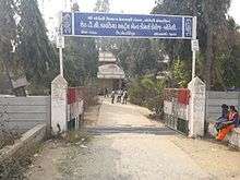
sheth T.C kapadia is the only college in bodeli town. this is the arts & commerce college.the students in this college are came from all villages around bodeli. archery team of this college is one of the best in the state.
Demographics

At the time of the 2001 India census,[2] Bodeli had a population of 10,494. Males constituted 52% of the population and females 48%.
Bodeli had an average literacy rate of 72%, higher than the national average of 59.5%;
with a male literacy rate of 78% and female literacy rate of 65%.
11% of the population were under 6 years of age.
Geography

Bodeli is situated on the river Orsang. It enjoys a variety of natural scenery.Garbi chowk is famous for garba in Bodeli. Here lots of people come together to play garba.The town has a number of industries including many big and small cement pipe factories, cotton mills and a sugar factory. There is a Baroda Dairy plant near Bodeli at Alhadpura. The Sardar Sarovar dam is around 100 km away from Bodeli. Pavagarh- Champaner is around 40 km from Bodeli

References
- ↑ "Process to set up Chhota Udepur district begins". Times of India. 9 February 2013. Retrieved 23 February 2013.
- ↑ "Census of India 2001: Data from the 2001 Census, including cities, villages and towns (Provisional)". Census Commission of India. Archived from the original on 2004-06-16. Retrieved 2008-11-01.
External links
- Best of Bodeli page on Instagram Best of Bodeli