Bledsoe, Texas
| Bledsoe, Texas | |
|---|---|
| Unincorporated community | |
 Bledsoe Location within the state of Texas  Bledsoe Bledsoe (the US) | |
| Coordinates: 33°37′09″N 103°01′17″W / 33.61917°N 103.02139°WCoordinates: 33°37′09″N 103°01′17″W / 33.61917°N 103.02139°W | |
| Country | United States |
| State | Texas |
| County | Cochran |
| Population (1990 est.) | |
| • Total | 125 |
| Time zone | UTC-6 (Central (CST)) |
| • Summer (DST) | UTC-5 (CDT) |
| ZIP codes | 79314 |
| Area code(s) | 806 |
Bledsoe is an unincorporated community in western Cochran County, Texas, located near the New Mexico border. It is about 68 miles west of Lubbock, Texas. As of the 1990 US Census, the town had a population of 125.
History
Bledsoe was founded in 1925 as the terminus of the Panhandle and Santa Fe Railway, and named for Samuel T. Bledsoe, the line's president.[1][2] The town gained its original prosperity through its function as a cattle-shipping station, and reached its greatest population of 400 in 1930. The Great Depression had dire effect on the community and throughout the remainder of the 20th century the population continued to dwindle; the last recorded figure put the 1990 population at 125.
See also
References
- ↑ Bledsoe, Texas from the Handbook of Texas Online Retrieved 2008-05-19.
- ↑ "Bledsoe, Texas". TexasEscapes.com. 2006-08-31. Retrieved 2008-05-19.
Municipalities and communities of Cochran County, Texas, United States | ||
|---|---|---|
| City | 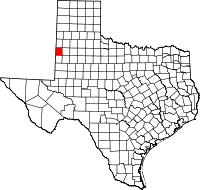 | |
| Town | ||
| Unincorporated community | ||
This article is issued from
Wikipedia.
The text is licensed under Creative Commons - Attribution - Sharealike.
Additional terms may apply for the media files.