Birketveit
| Birketveit Iveland | |
|---|---|
| Village | |
|
View of the village church | |
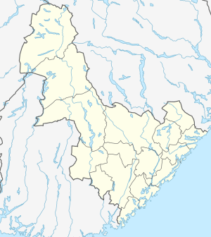
 Birketveit Location of the village  Birketveit Birketveit (Norway) | |
| Coordinates: 58°27′45″N 7°54′42″E / 58.4624°N 07.9118°ECoordinates: 58°27′45″N 7°54′42″E / 58.4624°N 07.9118°E | |
| Country | Norway |
| Region | Southern Norway |
| County | Aust-Agder |
| District | Setesdal |
| Municipality | Iveland |
| Elevation[1] | 206 m (676 ft) |
| Time zone | UTC+01:00 (CET) |
| • Summer (DST) | UTC+02:00 (CEST) |
| Post Code | 4724 Iveland |
Birketveit is the administrative centre of Iveland municipality in Aust-Agder county, Norway. The village is located about 8 kilometres (5.0 mi) north of the villages of Skaiå and Bakken and about 12 kilometres (7.5 mi) to the west of the village of Vatnestrøm. The Iveland Church is located on the south end of the village. The small lake Birketveitstjønna lies on the west side of the village. The municipal government building is located here and it houses a small mineral/mining museum. There is also a municipal sports hall in Birketveit.[2]
References
- ↑ "Birketveit, Iveland (Aust-Agder)". yr.no. Retrieved 2017-06-05.
- ↑ Thorsnæs, Geir, ed. (2015-07-20). "Birketveit". Store norske leksikon (in Norwegian). Kunnskapsforlaget. Retrieved 2017-06-05.
This article is issued from
Wikipedia.
The text is licensed under Creative Commons - Attribution - Sharealike.
Additional terms may apply for the media files.