Bir El Ater District
| Bir El Ater Districtt | |
|---|---|
| District | |
 | |
| Coordinates: Coordinates: 34°45′34.9″N 8°3′27.3″E / 34.759694°N 8.057583°E | |
| Country |
|
| Province | Tébessa Province |
| Chief town | Bir el-Ater |
| Area | |
| • Total | 985 sq mi (2,552 km2) |
| Population (2008) | |
| • Total | 83,626 |
| Time zone | UTC+1 (CET) |
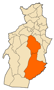
Bir el-Ater district is an Algerian administrative district located in the Province of Tébessa. Its chief town is located on the eponymous commune of Bir el-Ater.[1][2]
The district includes the two communes of Ogla Melha and Bir el-Ater.
References
- ↑ "Relation: Bir Elater District". OpenSteetMap. OpenSteetMap. Retrieved 2 May 2018.
- ↑ "Beer Eater". mapio. mapio. Retrieved 2 May 2018.
Capital: Tébessa | ||
| Districts |  | |
| Communes | ||
This article is issued from
Wikipedia.
The text is licensed under Creative Commons - Attribution - Sharealike.
Additional terms may apply for the media files.