Biržai Regional Park
| Biržai Regional Park | |
|---|---|
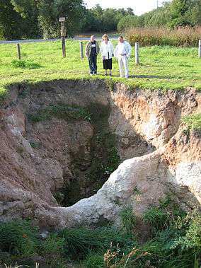 Sinkhole formed in 2004 | |
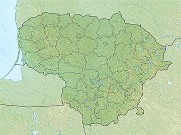 Map of Lithuania | |
| Location | Panevėžys County, Lithuania |
| Nearest city | Biržai |
| Coordinates | 56°12′04″N 24°39′32″E / 56.201°N 24.659°E[1]Coordinates: 56°12′04″N 24°39′32″E / 56.201°N 24.659°E[2] |
| Area | 14,659 hectares (36,220 acres) |
| Established | 1992 |
Biržai Regional Park covers 14,659 hectares (36,220 acres) in northern Lithuania near its border with Latvia. It was established in 1992 to preserve a distinctive karst landscape. About 20% of its area is covered by forest.
The park is notable for its sinkholes, created by the dissolution of the gypsum underlying its soil. About 9,000 sinkholes have been identified; the most notable is the Karves uola (Cow's Cave), which is about 20 meters deep.[3] In 1998 the use of pesticides and fertilizers in the area was restricted.
Footnotes
- ↑ "Birzu regioninis parkas State Park". protectedplanet.net.
- ↑ "Birzu regioninis parkas State Park". protectedplanet.net.
- ↑ "PROJECT ENVIRONMENT". European Commission. Retrieved 2009-06-16.
References
- (in Lithuanian) Titulinis. Biržai district municipality.
- Directorate of Birzai regional park. Association of Lithuanian State Parks and Reserves.
- Central and Eastern European Sustainable Agriculture. Food and Agriculture Organization of the United Nations.
- Sinkholes and subsidence. Tony Waltham, Frederic Gladstone Bell, M. G. Culshaw, Springer, 2005, ISBN 3-540-20725-2.
This article is issued from
Wikipedia.
The text is licensed under Creative Commons - Attribution - Sharealike.
Additional terms may apply for the media files.