Bikeway selection
Several manuals and procedures are available to aid jurisdictions in planning roadway treatments and cycling infrastructure.

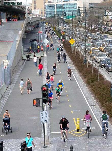
Traffic volume and speed
Sustrans Design Manual provides guidelines on both the type and level of service required for a cycling route.[1] Both motor vehicle traffic volume and speed influence the decision on the need to segregate cyclists from other traffic. In some cases, authorities lower traffic speed limits, and reduce volumes through traffic calming measures to encourage cyclists to use the roadway. Main cycle routes get a higher level of service than other cycle routes. Main cycle routes are more likely to have segregation and wider widths to accommodate higher cycling traffic.
With average car traffic speeds above 40 mph, or with traffic volumes above 10,000 motor vehicles per day, Sustrans recommends physical separation. On roads that exceed both, they recommend physical separation with a road verge (boulevard).
Prioritizing based on a pre-set hierarchy
In 1996, the British Cyclists Touring Club (CTC) and the Institute for Highways and Transportation jointly produced the document "Cycle-friendly infrastructure: Guidelines for planning and design".[2] This defined a hierarchy of measures for cycling promotion that seek to improve roads infrastructure to encourage and facilitate cycling.
- Traffic reduction. Can motor traffic levels, particularly of heavy vehicles, be reduced?
- Traffic calming. Can speed be reduced and driver behaviour modified?
- Junction treatment and traffic management. These measures include:
- Urban traffic control systems designed to recognise cyclists and give them priority.
- Exempt cyclists from banned turns and access restrictions.
- Provide contra-flow cycle lanes on one-way streets.
- Implement on-street parking restrictions.
- Junction alterations, roundabouts with cycle paths around them, cycle-friendly junction design.
- Redistribution of the carriageway -such as by marking wide curb lanes or shared bus/cycle lanes.
- Cycle lanes and cycle tracks. Having considered and implemented all the above, what cycle tracks or cycle lanes are considered necessary?
Bikeway selection in the Netherlands
It is standard practice in the Netherlands to physically separate cyclists from motor traffic, except for on the quietest local streets and those designated as bicycle streets. The Netherlands has thousands of kilometres of cycle paths and cycle tracks, more often the former—and most intersections are bike friendly. Traffic signals are rare on most people's cycle journeys in smaller municipalities (under 120 thousand people) and are only slightly more frequent in larger cities. Most traffic light-controlled intersections have some sort of curb to create cycle paths on the junctions themselves, often permitting turns on red. More intersections are built as roundabouts. Most cities give cyclists the right of way over exiting and entering traffic on an annular cycle path, but some municipalities (notably Tilburg and Assen) give the motorists the right of way. Cycle lanes usually transition into cycle paths at junctions.
References
- ↑ "Sustrans Design Manual" (PDF). Retrieved 8 July 2015.
- ↑ Cycle-Friendly Infrastructure: Guidelines for Planning and Design Archived 2012-02-07 at the Wayback Machine., Institution of Highways and Transportation, Cyclists Touring Club, 1996.
| General | |
|---|---|
| Utility and slow recreation | |
| Sports-related cycling and fast-paced recreation | |
| Health, safety and infrastructure |
|
| Other | |
| Lists | |
| |