Big port Saint Petersburg
| Unitary enterprise | |
| Industry | Seamanship |
| Genre | Ship navigation |
| Headquarters | Saint Petersburg, Russia |
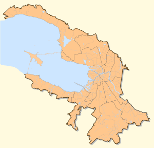
Area served | Gulf of Finland (Baltic sea) |
| Services | Ship navigation |
| Website | Official site in russian |
Big port Saint Petersburg (Russian Большой порт Санкт-Петербург, official name is Federal official body "Administration of seaport the Big port St.-Petersburg") is the state enterprise providing the organisation of trading navigation in sea port Saint Petersburg and behind its limits in established zones of responsibility of the Russian Federation.
Overview
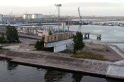
The port St.-Petersburg is located on islands of Neva Delta, in Neva Bay in east part of gulf of Finland of Baltic sea and there is one in Russia built by Peter the Great right after he went on the "Grand Embassy". Big port St.-Petersburg includes moorings of sea trading, wood, fish and river ports, the oil terminal, shipbuilding, ship-repair and other factories, sea passenger station, river passenger port, and also moorings of Kronstadt, Lomonosov, Gorskaya, Bronka. From a deep-water part of the sea to them the branched out system of channels and waterways conducts.
This economy is served by railway stations of October railway. The port fleet serving the Big port Saint Petersburg, includes a considerable quantity of the auxiliary vessels belonging to the various organisations, including more than twenty tow boats of varying thickness, ice breakers, oil garbage disposal vessel, water carrying boats, bilge water collectors, fuel vessel ships, pilotage vessels, road boats, a fire vessel, various not self-propelled waterborne vehicles.[1]
Historically port borders have not been defined that disturbed to work of the stevedore companies is under the law in such territories import-export cargoes cannot be overloaded. Borders tried to coordinate since 2006, with 2006 on 2008 it was not possible to coordinate borders in the absence of is standard-legal base, in 2008-2009 to pass this law disagreements between St. Petersburg government and the Minister of Defence of the Russian Federation did not allow. As a result, the prime minister of Russia Vladimir Putin ON August, 20th, 2009 has signed the order number 1225-r, in the appendix to which geographical coordinates more than 6,7 thousand points of border of port are listed[2] It will allow to realise scale investment projects of the stevedore companies.[3]
Operating rate
In Big port Saint Petersburg mineral oil, metals, wood cargoes, containers, coal, ore, chemical cargoes, scrap metal are overloaded. The port turnover of goods for 12 months 2008 has made 59,945 thousand tonnes.[4]
The basic stevedoring companies working in territory of the Big port Saint Petersburg, are Open Society "Seaport St.-Petersburg", companies "Nevas-metals", "Baltic balkerniy terminal", "Mobi-Dik", "Petersburg oil terminal", "First Container Terminal", Open Society "Petrolesport".
References
- ↑ "Official Data of Rosmorport Unitary enterprise" (in Russian). Rosmorport Unitary enterprise. Retrieved 2009-08-05.
- ↑ "The government of the Russian Federation. Order number 1225-r from August, 20th, 2009 (About an establishment of borders of seaport the Big port St.-Petersburg) (Правительство Российской Федерации. Распоряжение номер 1225-р от 20 августа 2009 года (Об установлении границ морского порта Большой порт Санкт-Петербург))" (in Russian). 2009-08-20. Retrieved 2009-09-21.
- ↑ "Putin has established borders of the Big port of Petersburg (Путин установил границы Большого порта Петербурга)". Business (in Russian). fontanka.ru. 2009-08-26. Archived from the original on 27 October 2009. Retrieved 2009-09-21.
- ↑ "Turnover of goods of the Big port Saint Petersburg and port Primorsk for 12 months 2008 (Грузооборот Большого морского порта Санкт-Петербурга и порта Приморск за 12 месяцев 2008 года)" (in Russian). Official site. 2009-01-22. Archived from the original on May 3, 2009. Retrieved 2009-08-07.
St. Petersburg sea and river terminals | ||
|---|---|---|
| River terminal |
| |
| Sea transport: |
| |
| Passenger seaports |
| |
| Cargo seaports |
| |
| Multitasking ports |
| |
| ||
Coordinates: 59°52′50″N 30°11′57″E / 59.88056°N 30.19917°E