Beverley/Linley Hill Airfield
| Beverley/Linley Hill Airfield | |||||||||||
|---|---|---|---|---|---|---|---|---|---|---|---|
 | |||||||||||
| Summary | |||||||||||
| Airport type | Private | ||||||||||
| Operator | Hull Aero Club | ||||||||||
| Location | Beverley | ||||||||||
| Elevation AMSL | 3 ft / 1 m | ||||||||||
| Coordinates | 53°53′54″N 000°21′41″W / 53.89833°N 0.36139°WCoordinates: 53°53′54″N 000°21′41″W / 53.89833°N 0.36139°W | ||||||||||
| Map | |||||||||||
 EGNY Location in the East Riding of Yorkshire | |||||||||||
| Runways | |||||||||||
| |||||||||||
|
Sources: Hull Aero Club[1] | |||||||||||
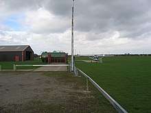
Beverley/Linley Hill Airfield (ICAO: EGNY) is an unlicensed aerodrome located 4 nautical miles (7.4 km; 4.6 mi) north-east of Beverley, East Riding of Yorkshire, England.
Beverley/Linley Hill had a CAA Ordinary Licence (Number P762) that allowed flights for the public transport of passengers or for flying instruction as authorised by the licensee (Hull Aero Club Limited). The aerodrome was not licensed for night use.[2] The aerodrome ceased to be licensed in 2011 [3]
References
- ↑ Hull Aero Club Archived 16 August 2014 at the Wayback Machine.
- ↑ Civil Aviation Authority Aerodrome Ordinary Licences Archived 28 June 2007 at the Wayback Machine.
- ↑ "How to Find Hull Aero Club". Archived from the original on 4 October 2013. Retrieved 3 October 2013.
External links
This article is issued from
Wikipedia.
The text is licensed under Creative Commons - Attribution - Sharealike.
Additional terms may apply for the media files.