Betlanovce
| Betlanovce | |
| Village | |
 Main road in Betlanovce | |
| Country | Slovakia |
|---|---|
| Region | Košice |
| District | Spišská Nová Ves |
| Elevation | 546 m (1,791 ft) |
| Coordinates | 48°58′N 20°23′E / 48.967°N 20.383°ECoordinates: 48°58′N 20°23′E / 48.967°N 20.383°E |
| Area | 10.124 km2 (3.91 sq mi) |
| Population | 636 (2004-12-31) |
| Density | 63/km2 (163/sq mi) |
| First mentioned | 1311 |
| Postal code | 053 15 |
| Area code | +421-53 |
| Car plate | SN |
  Location of Betlanovce in Slovakia | |
 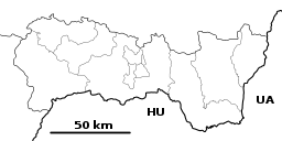 Location of Betlanovce in the Košice Region | |
| Statistics: MOŠ/MIS | |
Betlanovce is a village and municipality in the Spišská Nová Ves District in the Košice Region of central-eastern Slovakia.
History
The name "Terra Bethlem", the earth of Bethlem, was mentioned as early as 1260 in a written document. In historical records the village itself was first mentioned in 1311 as "villa Bethlem", meaning a village belonging to Bethlem.
The village was once part of the County of the Ten Lance-bearers (Sedes X lanceatorum), a historical autonomous administrative unit within the wider Spiš county. The County of the Ten Lance-bearers existed between the 12th century and 1802, when it merged with the Spiš county proper. Between 1725 and 1803 this institution resided in Betlanovce.
Geography
The village lies at an altitude of 546 metres and covers an area of 10.124 km². It has a population of about 638 people.
Cultural monuments
- Renaissance manor house of the Thurzó family
Genealogical resources
The records for genealogical research are available at the state archive "Statny Archiv in Levoca, Slovakia"
- Roman Catholic church records (births/marriages/deaths): 1703-1903 (parish B)
- Lutheran church records (births/marriages/deaths): 1710-1895 (parish B)
See also
External links
- http://en.e-obce.sk/obec/betlanovce/betlanovce.html
- http://www.betlanovce.sk
- Surnames of living people in Betlanovce