Besòs (river)
| Besòs | |
|---|---|
 | |
| Country | Spain |
| Physical characteristics | |
| River mouth |
Mediterranean Sea 0 m (0 ft) 41°27′29″N 2°11′39″E / 41.45806°N 2.19417°ECoordinates: 41°27′29″N 2°11′39″E / 41.45806°N 2.19417°E |
| Length | 17.7 km (11.0 mi) |
| Discharge |
|
| Basin features | |
| Basin size | 1,039 km2 (401 sq mi) |
The Besòs (Catalan pronunciation: [bəˈzɔs]) is a river flowing through Catalonia, Spain, formed by the confluence of the Mogent and Congost rivers.[1] It ends in the Mediterranean. Its full watershed includes the following cities: Aiguafreda, La Garriga, Sant Fost de Campsantelles, Canovelles, Granollers, Montmeló, Mollet del Vallès, Montcada i Reixac, Santa Coloma de Gramenet, Barcelona and Sant Adrià de Besòs. Due to its Mediterranean climate, the river can have an extreme discrepancies in flow depending on the weather.
Tributaries
The Besòs river has five main tributaries:[2]
- Congost River
- Ripoll River
- Mogent River
- Tenes River
- de Caldes stream
History
A non-navigable river, the Besòs was nonetheless a link between the Catalan coast and the interior. In the 10th century, the Rec Comtal was built to use the river for irrigation.
As it passes through a highly industrialized area (Barcelona metropolitan region), it had the dubious honor of being the most contaminated river in Europe during the 1970s and 1980s. Since the mid-1990s, however, the river has been in the process of recovery. The Fòrum Universal de les Cultures, which took place in Barcelona during 2004, allowed the creation of a recreation area called Parc Fluvial del Besòs between the cities of Barcelona, Santa Coloma de Gramenet and Sant Adrià del Besòs.
Gallery
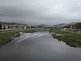 View from Sant Adrià de Besòs to the mountains
 View from Sant Adrià de Besòs to the sea
 The river mouth
See also
References
- ↑ "Besós River". Encyclopædia Britannica. Encyclopædia Britannica. Retrieved 13 April 2016.
- ↑ "La Conca del Besòs". Consorci per a la Defensa de la Conca del riu Besòs. Retrieved 13 April 2016.