Bennington, Idaho
| Bennington | |
|---|---|
| Census-designated place | |
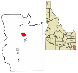 Location of Bennington in Bear Lake County, Idaho. | |
 Bennington Location within the state of Idaho | |
| Coordinates: 42°23′28″N 111°19′15″W / 42.39111°N 111.32083°WCoordinates: 42°23′28″N 111°19′15″W / 42.39111°N 111.32083°W | |
| Country | United States |
| State | Idaho |
| County | Bear Lake |
| Area | |
| • Total | 6.342 sq mi (16.43 km2) |
| • Land | 6.338 sq mi (16.42 km2) |
| • Water | 0.004 sq mi (0.01 km2) |
| Population (2010) | |
| • Total | 190 |
| • Density | 30/sq mi (12/km2) |
| Time zone | UTC-7 (Mountain (MST)) |
| • Summer (DST) | UTC-6 (MDT) |
| FIPS code | 16-06670 |
| GNIS feature ID | 396104[1] |
Bennington is an unincorporated census-designated place in Bear Lake County, Idaho, United States. As of the 2010 census, its population was 190.[2] It is located in the southeast corner of the (State of Idaho) on U.S. Route 30 about five miles north of Montpelier and 12 miles south of Georgetown. Bennington is a small farming community settled by Mormon Pioneers in 1864. It was named by Brigham Young after a town in Vermont near where he was born and grew up. Many of the inhabitants in Bennington are direct descendants of these early pioneers.
Its elevation is 6,053 ft (1,845 m).[1]
Demographics
| Historical population | |||
|---|---|---|---|
| Census | Pop. | %± | |
| U.S. Decennial Census[3] | |||
Notable people
- John Tippets, Idaho State Senator.
References
- 1 2 "Bennington, Idaho". Geographic Names Information System. United States Geological Survey.
- ↑ "American FactFinder". U.S. Census Bureau. Retrieved 22 March 2011.
- ↑ "Census of Population and Housing". Census.gov. Retrieved June 4, 2016.
Municipalities and communities of Bear Lake County, Idaho, United States | ||
|---|---|---|
| Cities | ||
| CDP | ||
| Unincorporated communities | ||
This article is issued from
Wikipedia.
The text is licensed under Creative Commons - Attribution - Sharealike.
Additional terms may apply for the media files.