Benedenheul
| Benedenheul | |
|---|---|
| Hamlet | |
 | |
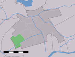 The village (dark green) and the statistical district (light green) of Benedenheul in the former municipality of Vlist. | |
| Coordinates: 51°57′10″N 4°43′12″E / 51.95278°N 4.72000°ECoordinates: 51°57′10″N 4°43′12″E / 51.95278°N 4.72000°E | |
| Country | Netherlands |
| Province | South Holland |
| Municipality | Krimpenerwaard |
| Time zone | UTC+1 (CET) |
| • Summer (DST) | UTC+2 (CEST) |
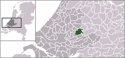
Benedenheul is a hamlet in the Dutch province of South Holland. It is a part of the municipality of Krimpenerwaard, and lies about 7 km south of Gouda.
The statistical area "Benedenheul", which also can include the surrounding countryside, has a population of around 240.[1]
Until 2015, Benedenheul was part of Vlist.
References
- ↑ Statistics Netherlands (CBS), Statline: Kerncijfers wijken en buurten 2003-2005. As of 1 January 2005.
This article is issued from
Wikipedia.
The text is licensed under Creative Commons - Attribution - Sharealike.
Additional terms may apply for the media files.