Belvoir, Virginia
| Belvoir, Virginia | |
|---|---|
| Unincorporated community | |
 Belvoir Location within the state of Virginia  Belvoir Belvoir (Virginia)  Belvoir Belvoir (the US) | |
| Coordinates: 38°39′27″N 77°43′01″W / 38.65750°N 77.71694°WCoordinates: 38°39′27″N 77°43′01″W / 38.65750°N 77.71694°W | |
| Country | United States |
| State | Virginia |
| County | Fauquier |
| Time zone | UTC−5 (Eastern (EST)) |
| • Summer (DST) | UTC−4 (EDT) |
| ZIP codes | 20189 |
Belvoir is a small, unincorporated community in Fauquier County, Virginia. It is situated between the towns of Marshall and The Plains. It is off US Route 17, at the crossroads of the John Marshall Highway (State Route 55), Zulla Road (State Route 709), and Belvoir Road (State Route 709). Because of the development of Marshall and The Plains, Belvoir as a hamlet has lost local relevance. The area is usually referred to as The Plains because it shares its ZIP Code of 20189.
Municipalities and communities of Fauquier County, Virginia, United States | ||
|---|---|---|
| Towns | 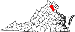 | |
| CDPs | ||
| Unincorporated communities | ||
| Footnotes | ‡This populated place also has portions in an adjacent county or counties | |
This article is issued from
Wikipedia.
The text is licensed under Creative Commons - Attribution - Sharealike.
Additional terms may apply for the media files.