Beit Elazari
| Beit Elazari בֵּית אֶלְעָזָרִי | |
|---|---|
 | |
 Beit Elazari | |
| Coordinates: 31°50′36.95″N 34°48′15.47″E / 31.8435972°N 34.8042972°ECoordinates: 31°50′36.95″N 34°48′15.47″E / 31.8435972°N 34.8042972°E | |
| District | Central |
| Council | Brenner |
| Affiliation | Moshavim Movement |
| Founded | 1948 |
| Founded by | Eastern European Jewish immigrants |
| Population (2017)[1] | 1,543 |
| Name meaning | House of Elazari |
| Website | www.beitelazari.co.il |
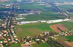
Beit Elazari (Hebrew: בֵּית אֶלְעָזָרִי, lit. House of Elazari; Arabic: بيت إلعزاري) is a moshav in central Israel. Located three miles south of the city of Rehovot, it falls under the jurisdiction of Brenner Regional Council. In 2017 it had a population of 1,543.[1]
History
It was founded in 1948 by Jewish immigrants from eastern Europe, on the site of the depopulated Palestinian village of al-Maghar.[2] Initially named Arugot (Hebrew: ערוגות), it was later renamed Ekron HaHadasha (Hebrew: עקרון החדשה, lit. New Ekron) and then to its current name after the agronomist Yitzhak Elazari-Volcani, the founder of modern agriculture in Israel.[3] It was the first moshav established by new immigrants, who included Avraham Zilberberg, later a member of the Knesset.[4]
Notable residents
- Danny Markovitch Slor of Marbin, saxophonist-composer
- Avraham Zilberberg, member of the Knesset
See also
References
- 1 2 "List of localities, in Alphabetical order" (PDF). Israel Central Bureau of Statistics. Retrieved August 26, 2018.
- ↑ Khalidi, Walid (1992). All That Remains: The Palestinian Villages Occupied and Depopulated by Israel in 1948. Washington D.C.: Institute for Palestine Studies. p. 395. ISBN 0-88728-224-5.
- ↑ Mapa's concise gazetteer of Israel (in Hebrew). Yuval El'azari (ed.). Tel-Aviv: Mapa Publishing. 2005. p. 64. ISBN 965-7184-34-7.
- ↑ Avraham Zilberberg: Public Activities Knesset website
External links
- Moshav website (in Hebrew)