Behera
| Behera | |
|---|---|
| town | |
 Behera Location in Odisha, India | |
| Coordinates: 19°44′57″N 82°59′7″E / 19.74917°N 82.98528°ECoordinates: 19°44′57″N 82°59′7″E / 19.74917°N 82.98528°E | |
| Country |
|
| State | Odisha |
| District | Kalahandi |
| Government | |
| • Type | Local Self Government. |
| • Body | Gram Panchayat |
| Population (2001) | |
| • Total | 5,800 |
| Languages | |
| • Official | Odia |
| Time zone | UTC+5:30 (IST) |
| PIN | 766103 |
| Telephone code | 06672 |
| Sex ratio | 49:51 ♂/♀ |
| Land of Goddess Maa Danteswari | |
Behera ( /bɛˈhɛˈrɑː/ (![]()
Demographics
As of 2011 census,[1] Total Population of Behera was 6,948, where it constitutes 52% of male and 48% female. Behera had a total literacy population of 5,947, from which male literacy 90% and female literacy 60%. Total SC population of this town was 1526 and Total ST population was 2246. As per census 2011 it is estimated that the population of Behera is near about 6948.
Written and spoken languages
The chief communicative language of the village is Sambalpuri odia. English and Odia are used for official purpose
Education
Schools
- Govt.Danteswari High School, Behera
- Govt.U.P and M.E Nodal School
- Tandapara U.P School
- Saraswati Sishu Vidya Mandir
- Kasturaba Gandhi Abasika Balika Vidyalaya
- G.M Public School
- Govt Primary School Bankimunda, Behera
- Bharuamunda Primary School, Behera
- Primary School Gaintapada, Behera
- Centre Primary School, Nunpani, Behera
- Primary School (New) Pipalpada Behera
Colleges
- Lakhiram Agrawal College
Hospitals nearby
- Primary Health Centre, Behera
- Office Of The Assistant Veterinary surgeon, Behera
- Homeopathy Hospital Behera
- Sub health centre Behera
Temples
- Goddess Danteswari Temple
- Lord Shiva Temple
- Lord Jagannath Temple
- Sri Budharaja Temple
- Hanuman Temple
- Manpuriani Temple Behera
- Sarbajanina Durga Mandap.
 Maa Danteswari in middle
 Maa Danteswari Ghant
 Inside The Temple
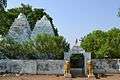 Temple Front
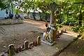 Inside The Temple
Arts
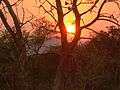
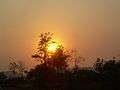
Views
Cultivation
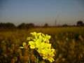
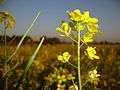
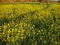
Generally in Behera, many kinds of cereal and pulses are cultivated, mainly paddy and maize. It is a market place for surrounding small villages, and is also one of the main grain collection centers in Kalahandi District. Most people are dependent on agriculture as their source of income. Two rice mills are situated here to process the paddy. Rice is the main grain which is cultivated in this area. Nearly 2 lakh quintals of paddy and one lakh quintals of maize are collected and produced here. Chidanand Rice Mill is located in Behera. It has 3 sortex rice mills and 2 Plane rice mills. Panigrahi Farm House is located nearby Behera.


References
- ↑ "Archived copy". Archived from the original on 2014-06-08. Retrieved 2014-06-22.