Beaussais
| Beaussais | |
|---|---|
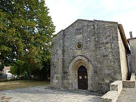 The Protestant temple in Beaussais | |
 Beaussais Location within Nouvelle-Aquitaine region  Beaussais | |
| Coordinates: 46°17′28″N 0°09′06″W / 46.2911°N .15167°WCoordinates: 46°17′28″N 0°09′06″W / 46.2911°N .15167°W | |
| Country | France |
| Region | Nouvelle-Aquitaine |
| Department | Deux-Sèvres |
| Arrondissement | Niort |
| Canton | Celles-sur-Belle |
| Intercommunality | Celles-sur-Belle |
| Government | |
| • Mayor (2008–2014) | Alain Daniault |
| Area1 | 15.75 km2 (6.08 sq mi) |
| Population (2006)2 | 403 |
| • Density | 26/km2 (66/sq mi) |
| Time zone | UTC+1 (CET) |
| • Summer (DST) | UTC+2 (CEST) |
| INSEE/Postal code | 79030 /79370 |
| Elevation |
112–187 m (367–614 ft) (avg. 150 m or 490 ft) |
|
1 French Land Register data, which excludes lakes, ponds, glaciers > 1 km2 (0.386 sq mi or 247 acres) and river estuaries. 2 Population without double counting: residents of multiple communes (e.g., students and military personnel) only counted once. | |
Beaussais is a former commune in the Deux-Sèvres department in the Poitou-Charentes region in western France. It merged into the new commune of Beaussais-Vitré on 1 January 2013.[1]
See also
References
| Wikimedia Commons has media related to Beaussais. |
This article is issued from
Wikipedia.
The text is licensed under Creative Commons - Attribution - Sharealike.
Additional terms may apply for the media files.