Bearfort Mountain
| Bearfort Mountain | |
|---|---|
| Bearfort Ridge | |
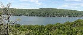 Bearfort Mountain (left), Bellvale Mountain (right) | |
| Highest point | |
| Peak | Bearfort Mountain |
| Elevation | 1,479 ft (451 m) |
| Coordinates | 41°8′14″N 74°23′52″W / 41.13722°N 74.39778°WCoordinates: 41°8′14″N 74°23′52″W / 41.13722°N 74.39778°W |
| Geography | |
| Country | United States |
| State | New Jersey |
| Geology | |
| Age of rock | Devonian |
| Type of rock | Skunnemunk Conglomerate |
Bearfort Mountain is a mountain ridge located near Wawayanda State Park in Passaic County, New Jersey.[1] It is a continuation of Bellvale Mountain in New York. The Appalachian Trail crosses along the ridge into New York.[2] Puddingstone of the Skunnemunk Conglomerate is visible along the ridge.[3]
At an elevation of 1,331 feet (406 m) the ridge is the site of a New Jersey Forest Fire Service fire observation tower, 68 feet (21 m) high.[4][5]
References
- ↑ "Beafort Mountain, New Jersey". Peakbagger.com.
- ↑ "State Line Trail/Ernest Walter Trail/A.T. Loop from Greenwood Lake Marina". New York–New Jersey Trail Conference.
- ↑ "Bearfort Mountain". U.S. Geological Survey.
- ↑ National Historic Lookout Register, Bearfort Fire Tower US 244, NJ 6. Retrieved 24 April 2015.
- ↑ New Jersey Forest Fire Service, "Wildfire Suppression: Division A Fire Towers". Retrieved 24 April 2015.
This article is issued from
Wikipedia.
The text is licensed under Creative Commons - Attribution - Sharealike.
Additional terms may apply for the media files.