Beadnos Nunatak

Location of Sentinel Range in Western Antarctica.
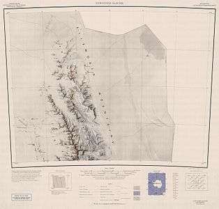
Map of northern Sentinel Range.
Beadnos Nunatak (Bulgarian: нунатак Беаднос, ‘Nunatak Beadnos’ \'nu-na-tak be-'ad-nos\) is the partly ice-free hill of elevation 2180 m projecting from the ice cap west of north-central Sentinel Range in Ellsworth Mountains, Antarctica. It is named after the medieval fortress of Beadnos in Southern Bulgaria.
Location
Beadnos Nunatak is located at 77°57′59″S 87°13′02″W / 77.96639°S 87.21722°WCoordinates: 77°57′59″S 87°13′02″W / 77.96639°S 87.21722°W, which is 6.64 km southeast of Helfert Nunatak, 20.78 km west-southwest of Mursalitsa Peak, 29 km west of Mount Dalrymple and 9 km northwest of Kovil Nunatak. US mapping in 1961.
Maps
- Newcomer Glacier. Scale 1:250 000 topographic map. Reston, Virginia: US Geological Survey, 1961.
- Antarctic Digital Database (ADD). Scale 1:250000 topographic map of Antarctica. Scientific Committee on Antarctic Research (SCAR). Since 1993, regularly updated.
References
- Beadnos Nunatak. SCAR Composite Gazetteer of Antarctica.
- Bulgarian Antarctic Gazetteer. Antarctic Place-names Commission. (details in Bulgarian, basic data in English)
This article includes information from the Antarctic Place-names Commission of Bulgaria which is used with permission.
This article is issued from
Wikipedia.
The text is licensed under Creative Commons - Attribution - Sharealike.
Additional terms may apply for the media files.